Landín geodata
Landín (Guanajuato) is a populated place; located in Mexico in America/Mexico_City (GMT-6) time zone. With population of 1,839 people, there are 4728 cities with bigger population in this country. Compared to other cities in Mexico, 72.6% of cities are located further ↓South; 72.7% of cities are located further →East and 71.1% of cities have lower elevation than Landín. Note1


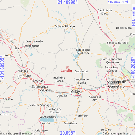
Landín GPS coordinates[2]
20° 45' 14.112" North, 100° 54' 21.312" West
| Map corner | latitude | longitude |
|---|---|---|
| Upper-left | 21.40998°, | -101.60905° |
| Center: | 20.75392°, | -100.90592° |
| Lower-right: | 20.095°, | -100.2028° |
| Map W x H: | 146.2×146.2 km | = 90.8×90.8mi |
| max Lat: | 32.7° ⇑27.4% North |
| Landín: | 20.75392° |
| min Lat: | ⇓72.6% South 14.53588° |
| min Long | Landín | max Long |
| -117.105° | -100.90592° | -86.73105° |
| W 27.3%⇐ | ⇒72.7% E |
Elevation
Elevation of Landín is 1949 m = 6394 ft, and this is 695.3 m = 2281 ft above average elevation for this country.
| Max E: |
3497 m = 11473 ft | 28.9% |
| Landín | 1949 m 6394 ft | |
| Avg. | 1253.7 m = 4113 ft | |
Min E: |
-1 m = -3 ft | 71.1% |
See also: Mexico elevation on elevation.city.
Geographical zone
Landín is located in North Torrid zone (between Equator and Tropic of Cancer). Distance of this Northern Tropic circle is 298.3 km =185.4 mi to North.| Distance of | km | miles | from Landín |
|---|---|---|---|
| North Pole | 7699.4 | 4784.2 | to North |
| Arctic Circle | 5093.6 | 3165 | to North |
| Tropic Cancer | 298.3 | 185.4 | to North |
| Equator | 2307.6 | 1433.9 | to South |


Nearby cities:
15 places around Landín: (largest is in red/bold)
• Cañada del Agua
5.9 km =3.7 mi,  191°
191°
• Delgado de Abajo
4.3 km =2.7 mi,  162°
162°
• Delgado de Arriba
3.6 km =2.2 mi,  171°
171°
• Don Diego
6.2 km =3.9 mi,  176°
176°
• El Murciélago
10.1 km =6.3 mi,  230°
230°
• El Naranjillo
10.8 km =6.7 mi,  245°
245°
• La Huerta
10.9 km =6.8 mi,  46°
46°
• Morales
10.4 km =6.5 mi,  74°
74°
• Neutla
8.6 km =5.3 mi,  126°
126°
• Ojo de Agua de García
5.1 km =3.2 mi,  321°
321°
• Palmillas de San Juan
4.6 km =2.9 mi, 69°
• Pocitos de Corrales
5.5 km =3.4 mi, 226°
• Rincón del Centeno
10.6 km =6.6 mi, 168°
• San Antonio de Corrales
6.1 km =3.8 mi,  261°
261°
• San Pablo
10.4 km =6.5 mi, 69°
Sources, notices
• [Note1] Compared only with cities in Mexico existing in our database
• [Src1] Map data: © OpenStreetMap contributors (CC-BY-SA)
• [Src2] Other city data from geonames.org with taken over terms of usage.
• [Src3] Geographical zone / Annual Mean Temperature by Robert A. Rohde @ Wikipedia
