Palmillas de San Juan geodata
Palmillas de San Juan (Guanajuato) is a populated place; located in Mexico in America/Mexico_City (GMT-6) time zone. With population of 1,467 people, there are 5888 cities with bigger population in this country. Compared to other cities in Mexico, 72.8% of cities are located further ↓South; 72.3% of cities are located further →East and 72.9% of cities have lower elevation than Palmillas de San Juan. Note1


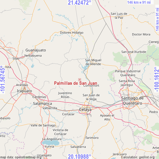
Palmillas de San Juan GPS coordinates[2]
20° 46' 7.428" North, 100° 51' 51.552" West
| Map corner | latitude | longitude |
|---|---|---|
| Upper-left | 21.42472°, | -101.56745° |
| Center: | 20.76873°, | -100.86432° |
| Lower-right: | 20.10988°, | -100.1612° |
| Map W x H: | 146.2×146.2 km | = 90.8×90.8mi |
| max Lat: | 32.7° ⇑27.2% North |
| Palmillas de San Juan: | 20.76873° |
| min Lat: | ⇓72.8% South 14.53588° |
| min Long | Palmillas de Sa | max Long |
| -117.105° | -100.86432° | -86.73105° |
| W 27.7%⇐ | ⇒72.3% E |
Elevation
Elevation of Palmillas de San Juan is 1987 m = 6519 ft, and this is 733.3 m = 2406 ft above average elevation for this country.
| Max E: |
3497 m = 11473 ft | 27.1% |
| Palmillas de San Juan | 1987 m 6519 ft | |
| Avg. | 1253.7 m = 4113 ft | |
Min E: |
-1 m = -3 ft | 72.9% |
See also: Mexico elevation on elevation.city.
Geographical zone
Palmillas de San Juan is located in North Torrid zone (between Equator and Tropic of Cancer). Distance of this Northern Tropic circle is 296.7 km =184.4 mi to North.| Distance of | km | miles | from Palmillas de San Juan |
|---|---|---|---|
| North Pole | 7697.8 | 4783.2 | to North |
| Arctic Circle | 5091.9 | 3164 | to North |
| Tropic Cancer | 296.7 | 184.4 | to North |
| Equator | 2309.3 | 1434.9 | to South |


Nearby cities:
15 places around Palmillas de San Juan: (largest is in red/bold)
• Calderón
8.1 km =5 mi,  57°
57°
• Cañada del Agua
9.2 km =5.7 mi,  216°
216°
• Delgado de Abajo
6.4 km =4 mi,  207°
207°
• Delgado de Arriba
6.4 km =4 mi, 216°
• Don Diego
8.8 km =5.5 mi, 206°
• La Huerta
6.9 km =4.3 mi,  30°
30°
• Landín
4.6 km =2.9 mi,  249°
249°
• Morales
5.8 km =3.6 mi,  79°
79°
• Neutla
7.2 km =4.5 mi,  159°
159°
• Ojo de Agua de García
7.9 km =4.9 mi,  287°
287°
• Orduña de Abajo
8.6 km =5.3 mi,  97°
97°
• Orduña de Arriba
7.5 km =4.7 mi,  92°
92°
• Presa Allende
9.7 km =6 mi,  23°
23°
• Rinconcillo (Rinconcillo de los Remedios)
6.6 km =4.1 mi,  69°
69°
• San Pablo
5.8 km =3.6 mi, 70°
Sources, notices
• [Note1] Compared only with cities in Mexico existing in our database
• [Src1] Map data: © OpenStreetMap contributors (CC-BY-SA)
• [Src2] Other city data from geonames.org with taken over terms of usage.
• [Src3] Geographical zone / Annual Mean Temperature by Robert A. Rohde @ Wikipedia
