Agustín González geodata
Agustín González (Guanajuato) is a populated place; located in Mexico in America/Mexico_City (GMT-6) time zone. With population of 515 people, there are 16340 cities with bigger population in this country. Compared to other cities in Mexico, 74.1% of cities are located further ↓South; 72.2% of cities are located further →East and 69.1% of cities have lower elevation than Agustín González. Note1


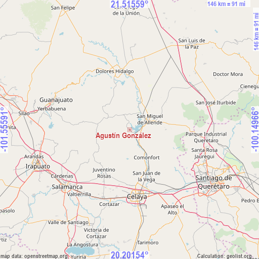
Agustín González GPS coordinates[2]
20° 51' 36" North, 100° 51' 10.008" West
| Map corner | latitude | longitude |
|---|---|---|
| Upper-left | 21.51559°, | -101.55591° |
| Center: | 20.86°, | -100.85278° |
| Lower-right: | 20.20154°, | -100.14966° |
| Map W x H: | 146.1×146.1 km | = 90.8×90.8mi |
| max Lat: | 32.7° ⇑25.9% North |
| Agustín González: | 20.86° |
| min Lat: | ⇓74.1% South 14.53588° |
| min Long | Agustín Gonzá | max Long |
| -117.105° | -100.85278° | -86.73105° |
| W 27.8%⇐ | ⇒72.2% E |
Elevation
Elevation of Agustín González is 1910 m = 6266 ft, and this is 656.3 m = 2153 ft above average elevation for this country.
| Max E: |
3497 m = 11473 ft | 30.9% |
| Agustín González | 1910 m 6266 ft | |
| Avg. | 1253.7 m = 4113 ft | |
Min E: |
-1 m = -3 ft | 69.1% |
See also: Mexico elevation on elevation.city.
Geographical zone
Agustín González is located in North Torrid zone (between Equator and Tropic of Cancer). Distance of this Northern Tropic circle is 286.5 km =178 mi to North.| Distance of | km | miles | from Agustín González |
|---|---|---|---|
| North Pole | 7687.6 | 4776.9 | to North |
| Arctic Circle | 5081.8 | 3157.7 | to North |
| Tropic Cancer | 286.5 | 178 | to North |
| Equator | 2319.4 | 1441.2 | to South |


Nearby cities:
15 places around Agustín González: (largest is in red/bold)
• Calderón
8 km =5 mi,  136°
136°
• Don Francisco
8.3 km =5.2 mi,  304°
304°
• Don Juan Xido de Abajo (Cabras de Begoña)
7.8 km =4.8 mi,  97°
97°
• Esperanza
9.8 km =6.1 mi,  44°
44°
• Flores de Begoña
6.1 km =3.8 mi,  79°
79°
• La Huerta
4.8 km =3 mi,  151°
151°
• Morales
10.2 km =6.3 mi, 153°
• Palmillas de San Juan
10.2 km =6.3 mi,  186°
186°
• Presa Allende
2.9 km =1.8 mi,  115°
115°
• Rinconcillo (Rinconcillo de los Remedios)
9.3 km =5.8 mi, 147°
• San Lucas
10.4 km =6.5 mi, 303°
• San Marcos de Begoña
5.4 km =3.4 mi,  111°
111°
• San Miguel Viejo
9.2 km =5.7 mi,  54°
54°
• San Pablo
9.2 km =5.7 mi, 152°
• Santa Teresita de Don Diego
8 km =5 mi,  73°
73°
Sources, notices
• [Note1] Compared only with cities in Mexico existing in our database
• [Src1] Map data: © OpenStreetMap contributors (CC-BY-SA)
• [Src2] Other city data from geonames.org with taken over terms of usage.
• [Src3] Geographical zone / Annual Mean Temperature by Robert A. Rohde @ Wikipedia
