San Lucas geodata
San Lucas (Guanajuato) is a populated place; located in Mexico in America/Mexico_City (GMT-6) time zone. With population of 608 people, there are 14173 cities with bigger population in this country. Compared to other cities in Mexico, 75% of cities are located further ↓South; 73% of cities are located further →East and 70.2% of cities have lower elevation than San Lucas. Note1


San Lucas GPS coordinates[2]
20° 54' 42.012" North, 100° 56' 8.988" West
| Map corner | latitude | longitude |
|---|---|---|
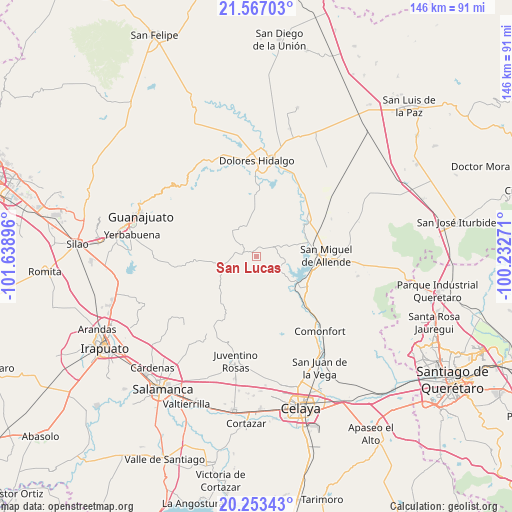
| Upper-left | 21.56703°, | -101.63896° |
| Center: | 20.91167°, | -100.93583° |
| Lower-right: | 20.25343°, | -100.23271° |
| Map W x H: | 146.1×146.1 km | = 90.8×90.8mi |
| max Lat: | 32.7° ⇑25% North |
| San Lucas: | 20.91167° |
| min Lat: | ⇓75% South 14.53588° |
| min Long | San Lucas | max Long |
| -117.105° | -100.93583° | -86.73105° |
| W 27%⇐ | ⇒73% E |
Elevation
Elevation of San Lucas is 1929 m = 6329 ft, and this is 675.3 m = 2216 ft above average elevation for this country.
| Max E: |
3497 m = 11473 ft | 29.8% |
| San Lucas | 1929 m 6329 ft | |
| Avg. | 1253.7 m = 4113 ft | |
Min E: |
-1 m = -3 ft | 70.2% |
See also: Mexico elevation on elevation.city.
Geographical zone
San Lucas is located in North Torrid zone (between Equator and Tropic of Cancer). Distance of this Northern Tropic circle is 280.8 km =174.5 mi to North.| Distance of | km | miles | from San Lucas |
|---|---|---|---|
| North Pole | 7681.9 | 4773.3 | to North |
| Arctic Circle | 5076 | 3154.1 | to North |
| Tropic Cancer | 280.8 | 174.5 | to North |
| Equator | 2325.2 | 1444.8 | to South |


Nearby cities:
15 places around San Lucas: (largest is in red/bold)
• Agustín González
10.4 km =6.5 mi,  123°
123°
• Don Francisco
2 km =1.2 mi, 119°
• Esperanza
15.6 km =9.7 mi,  85°
85°
• Flores de Begoña
15.3 km =9.5 mi,  107°
107°
• La Cantera
13.9 km =8.6 mi,  274°
274°
• La Cruz del Palmar
11.6 km =7.2 mi,  56°
56°
• La Huerta
14.8 km =9.2 mi,  132°
132°
• Los López
15.6 km =9.7 mi,  81°
81°
• Ojo de Agua de García
13.6 km =8.5 mi,  180°
180°
• Presa Allende
13.2 km =8.2 mi, 121°
• San Damián
3.7 km =2.3 mi,  324°
324°
• San José de Allende
11.8 km =7.3 mi,  238°
238°
• San Marcos de Abajo
14.8 km =9.2 mi,  325°
325°
• San Martín de Terreros
9.4 km =5.8 mi, 270°
• Xoconoxtle el Grande
5.6 km =3.5 mi,  302°
302°
Sources, notices
• [Note1] Compared only with cities in Mexico existing in our database
• [Src1] Map data: © OpenStreetMap contributors (CC-BY-SA)
• [Src2] Other city data from geonames.org with taken over terms of usage.
• [Src3] Geographical zone / Annual Mean Temperature by Robert A. Rohde @ Wikipedia
