Santiago Puriatzícuaro geodata
Santiago Puriatzícuaro (Michoacán) is a populated place; located in Mexico in America/Mexico_City (GMT-6) time zone. With population of 3,660 people, there are 2505 cities with bigger population in this country. Compared to other cities in Mexico, 54.8% of cities are located further ↓South; 70.2% of cities are located further →East and 92.1% of cities have lower elevation than Santiago Puriatzícuaro. Note1
Current local time in Santiago Puriatzícuaro:
12:54 AM, WednesdayDifference from your time zone: hours


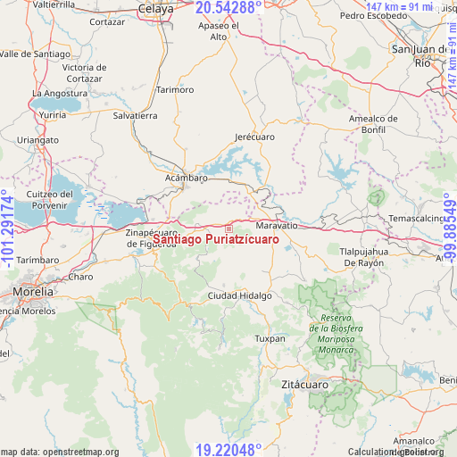
Santiago Puriatzícuaro GPS coordinates[2]
19° 52' 59.016" North, 100° 35' 18.996" West
| Map corner | latitude | longitude |
|---|---|---|
| Upper-left | 20.54288°, | -101.29174° |
| Center: | 19.88306°, | -100.58861° |
| Lower-right: | 19.22048°, | -99.88549° |
| Map W x H: | 147×147 km | = 91.3×91.3mi |
| max Lat: | 32.7° ⇑45.2% North |
| Santiago Puriatzícuaro: | 19.88306° |
| min Lat: | ⇓54.8% South 14.53588° |
| min Long | Santiago Puriat | max Long |
| -117.105° | -100.58861° | -86.73105° |
| W 29.8%⇐ | ⇒70.2% E |
Elevation
Elevation of Santiago Puriatzícuaro is 2487 m = 8159 ft, and this is 1233.3 m = 4046 ft above average elevation for this country.
| Max E: |
3497 m = 11473 ft | 7.9% |
| Santiago Puriatzícuaro | 2487 m 8159 ft | |
| Avg. | 1253.7 m = 4113 ft | |
Min E: |
-1 m = -3 ft | 92.1% |
See also: Mexico elevation on elevation.city.
Geographical zone
Santiago Puriatzícuaro is located in North Torrid zone (between Equator and Tropic of Cancer). Distance of this Northern Tropic circle is 395.1 km =245.5 mi to North.| Distance of | km | miles | from Santiago Puriatzícuaro |
|---|---|---|---|
| North Pole | 7796.3 | 4844.4 | to North |
| Arctic Circle | 5190.4 | 3225.2 | to North |
| Tropic Cancer | 395.1 | 245.5 | to North |
| Equator | 2210.8 | 1373.7 | to South |


Nearby cities:
15 places around Santiago Puriatzícuaro: (largest is in red/bold)
• Arroyo Colorado
14.4 km =8.9 mi,  345°
345°
• Barrio de San Miguel
8.1 km =5 mi,  36°
36°
• Buenavista
7.1 km =4.4 mi,  309°
309°
• Casa Blanca
14.9 km =9.3 mi,  98°
98°
• El Rodeo
9.5 km =5.9 mi,  337°
337°
• Heriberto Jara (La Presa)
3.4 km =2.1 mi, 337°
• Huajúmbaro
2.2 km =1.4 mi,  227°
227°
• La Purísima
15.2 km =9.4 mi, 36°
• Las Palomas
6.3 km =3.9 mi,  167°
167°
• Maravatío de Ocampo
15.1 km =9.4 mi,  86°
86°
• San Ildefonso
5.8 km =3.6 mi,  327°
327°
• San Miguel Curinhuato
11.5 km =7.1 mi,  3°
3°
• Tarandacuao
15 km =9.3 mi,  29°
29°
• Ucareo
10.3 km =6.4 mi,  279°
279°
• Uripitio
9.4 km =5.8 mi, 34°
Sources, notices
• [Note1] Compared only with cities in Mexico existing in our database
• [Src1] Map data: © OpenStreetMap contributors (CC-BY-SA)
• [Src2] Other city data from geonames.org with taken over terms of usage.
• [Src3] Geographical zone / Annual Mean Temperature by Robert A. Rohde @ Wikipedia
