Irapeo geodata
Irapeo (Michoacán) is a populated place; located in Mexico in America/Mexico_City (GMT-6) time zone. With population of 1,817 people, there are 4791 cities with bigger population in this country. Compared to other cities in Mexico, 50.2% of cities are located further ↓South; 73.9% of cities are located further →East and 72.3% of cities have lower elevation than Irapeo. Note1


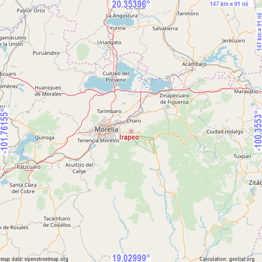
Irapeo GPS coordinates[2]
19° 41' 36.024" North, 101° 3' 30.312" West
| Map corner | latitude | longitude |
|---|---|---|
| Upper-left | 20.35396°, | -101.76155° |
| Center: | 19.69334°, | -101.05842° |
| Lower-right: | 19.02999°, | -100.3553° |
| Map W x H: | 147.2×147.2 km | = 91.5×91.5mi |
| max Lat: | 32.7° ⇑49.8% North |
| Irapeo: | 19.69334° |
| min Lat: | ⇓50.2% South 14.53588° |
| min Long | Irapeo | max Long |
| -117.105° | -101.05842° | -86.73105° |
| W 26.1%⇐ | ⇒73.9% E |
Elevation
Elevation of Irapeo is 1973 m = 6473 ft, and this is 719.3 m = 2360 ft above average elevation for this country.
| Max E: |
3497 m = 11473 ft | 27.7% |
| Irapeo | 1973 m 6473 ft | |
| Avg. | 1253.7 m = 4113 ft | |
Min E: |
-1 m = -3 ft | 72.3% |
See also: Mexico elevation on elevation.city.
Geographical zone
Irapeo is located in North Torrid zone (between Equator and Tropic of Cancer). Distance of this Northern Tropic circle is 416.2 km =258.6 mi to North.| Distance of | km | miles | from Irapeo |
|---|---|---|---|
| North Pole | 7817.4 | 4857.5 | to North |
| Arctic Circle | 5211.5 | 3238.3 | to North |
| Tropic Cancer | 416.2 | 258.6 | to North |
| Equator | 2189.7 | 1360.6 | to South |


Nearby cities:
15 places around Irapeo: (largest is in red/bold)
• Atapaneo
7.9 km =4.9 mi,  310°
310°
• Cañadas del Bosque
5.3 km =3.3 mi, 314°
• Charo
6.4 km =4 mi,  11°
11°
• Colonia José Vasconcelos
9.2 km =5.7 mi,  325°
325°
• Francisco I. Madero (El Pantano)
3.2 km =2 mi,  75°
75°
• Jaripeo
3.2 km =2 mi,  242°
242°
• La Aldea
9.7 km =6 mi,  304°
304°
• La Goleta
5.6 km =3.5 mi, 334°
• Las Mesas
4.4 km =2.7 mi,  212°
212°
• Puerto de Buenavista (Lázaro Cárdenas)
7.2 km =4.5 mi,  265°
265°
• San Antonio Corrales (Nuevo Coronillas)
9.1 km =5.7 mi, 9°
• San José de las Torres
7.6 km =4.7 mi, 237°
• Tres Marías
6.1 km =3.8 mi,  280°
280°
• Unión de Progreso (Lomas de Irapeo)
2.1 km =1.3 mi,  145°
145°
• Zurumbeneo
5 km =3.1 mi, 81°
Sources, notices
• [Note1] Compared only with cities in Mexico existing in our database
• [Src1] Map data: © OpenStreetMap contributors (CC-BY-SA)
• [Src2] Other city data from geonames.org with taken over terms of usage.
• [Src3] Geographical zone / Annual Mean Temperature by Robert A. Rohde @ Wikipedia
