Chupio geodata
Chupio (Michoacán) is a populated place; located in Mexico in America/Mexico_City (GMT-6) time zone. With population of 2,086 people, there are 4185 cities with bigger population in this country. Compared to other cities in Mexico, 61.6% of cities are located further ↑North; 76.9% of cities are located further →East and 55.5% of cities have higher elevation than Chupio. Note1


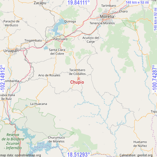
Chupio GPS coordinates[2]
19° 10' 42.096" North, 101° 26' 45.564" West
| Map corner | latitude | longitude |
|---|---|---|
| Upper-left | 19.84111°, | -102.14912° |
| Center: | 19.17836°, | -101.44599° |
| Lower-right: | 18.51293°, | -100.74287° |
| Map W x H: | 147.7×147.7 km | = 91.8×91.8mi |
| max Lat: | 32.7° ⇑61.6% North |
| Chupio: | 19.17836° |
| min Lat: | ⇓38.4% South 14.53588° |
| min Long | Chupio | max Long |
| -117.105° | -101.44599° | -86.73105° |
| W 23.1%⇐ | ⇒76.9% E |
Elevation
Elevation of Chupio is 1179 m = 3868 ft, and this is 74.7 m = 245 ft below average elevation for this country.
| Max E: |
3497 m = 11473 ft | 55.5% |
| Avg. | 1253.7 m = 4113 ft | |
| Chupio | 1179 m = 3868 ft | |
Min E: |
-1 m = -3 ft | 44.5% |
See also: Mexico elevation on elevation.city.
Geographical zone
Chupio is located in North Torrid zone (between Equator and Tropic of Cancer). Distance of this Northern Tropic circle is 473.5 km =294.2 mi to North.| Distance of | km | miles | from Chupio |
|---|---|---|---|
| North Pole | 7874.6 | 4893 | to North |
| Arctic Circle | 5268.7 | 3273.8 | to North |
| Tropic Cancer | 473.5 | 294.2 | to North |
| Equator | 2132.4 | 1325 | to South |


Nearby cities:
15 places around Chupio: (largest is in red/bold)
• Canícuaro
6.1 km =3.8 mi,  10°
10°
• El Terrero
10 km =6.2 mi,  304°
304°
• La Huerta
11.3 km =7 mi,  218°
218°
• La Loma
2.8 km =1.7 mi,  79°
79°
• La Viña
10 km =6.2 mi,  345°
345°
• Las Hoyas Altas
6.6 km =4.1 mi,  23°
23°
• Las Joyas (El Poblado)
3.4 km =2.1 mi,  26°
26°
• Ojo de Agua de Chupio
5.1 km =3.2 mi,  150°
150°
• Pedernales
4.8 km =3 mi,  210°
210°
• Petembo
8 km =5 mi, 218°
• San Miguel Tamácuaro
7.3 km =4.5 mi, 6°
• San Rafael Tecario
7.3 km =4.5 mi, 299°
• Tacámbaro de Codallos
6.4 km =4 mi, 348°
• Tecario
12 km =7.5 mi, 300°
• Testerazo
7.6 km =4.7 mi, 349°
Sources, notices
• [Note1] Compared only with cities in Mexico existing in our database
• [Src1] Map data: © OpenStreetMap contributors (CC-BY-SA)
• [Src2] Other city data from geonames.org with taken over terms of usage.
• [Src3] Geographical zone / Annual Mean Temperature by Robert A. Rohde @ Wikipedia
