Rincón de Ugarte geodata
Rincón de Ugarte (State of Mexico) is a populated place; located in Mexico in America/Mexico_City (GMT-6) time zone. With population of 749 people, there are 11695 cities with bigger population in this country. Compared to other cities in Mexico, 66.4% of cities are located further ↑North; 65.9% of cities are located further →East and 50.7% of cities have higher elevation than Rincón de Ugarte. Note1


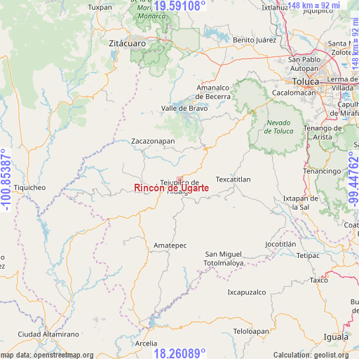
Rincón de Ugarte GPS coordinates[2]
18° 55' 38.316" North, 100° 9' 2.664" West
| Map corner | latitude | longitude |
|---|---|---|
| Upper-left | 19.59108°, | -100.85387° |
| Center: | 18.92731°, | -100.15074° |
| Lower-right: | 18.26089°, | -99.44762° |
| Map W x H: | 147.9×147.9 km | = 91.9×91.9mi |
| max Lat: | 32.7° ⇑66.4% North |
| Rincón de Ugarte: | 18.92731° |
| min Lat: | ⇓33.6% South 14.53588° |
| min Long | Rincón de Ugar | max Long |
| -117.105° | -100.15074° | -86.73105° |
| W 34.1%⇐ | ⇒65.9% E |
Elevation
Elevation of Rincón de Ugarte is 1395 m = 4577 ft, and this is 141.3 m = 464 ft above average elevation for this country.
| Max E: |
3497 m = 11473 ft | 50.7% |
| Rincón de Ugarte | 1395 m 4577 ft | |
| Avg. | 1253.7 m = 4113 ft | |
Min E: |
-1 m = -3 ft | 49.3% |
See also: Mexico elevation on elevation.city.
Geographical zone
Rincón de Ugarte is located in North Torrid zone (between Equator and Tropic of Cancer). Distance of this Northern Tropic circle is 501.4 km =311.6 mi to North.| Distance of | km | miles | from Rincón de Ugarte |
|---|---|---|---|
| North Pole | 7902.5 | 4910.4 | to North |
| Arctic Circle | 5296.7 | 3291.2 | to North |
| Tropic Cancer | 501.4 | 311.6 | to North |
| Equator | 2104.5 | 1307.7 | to South |


Nearby cities:
15 places around Rincón de Ugarte: (largest is in red/bold)
• Almoloya de las Granadas
5.1 km =3.2 mi,  22°
22°
• Colonia Buenavista Primera Sección
1.6 km =1 mi,  205°
205°
• Jalpan (Jalpan San Simón)
1.4 km =0.9 mi,  265°
265°
• La Labor de Zaragoza
8.3 km =5.2 mi,  138°
138°
• Rincón de Aguirre
3.4 km =2.1 mi,  154°
154°
• Rincón de Jaimes
3.6 km =2.2 mi, 205°
• Rincón del Carmen
4.2 km =2.6 mi,  131°
131°
• San Andrés Ocotepec
11.3 km =7 mi,  103°
103°
• San Diego Cuentla (Llano Grande)
9.7 km =6 mi,  63°
63°
• San Gabriel Cuentla
11 km =6.8 mi,  65°
65°
• San José de la Laguna
3 km =1.9 mi,  314°
314°
• Sauz de San Lucas (El Sauz)
11.5 km =7.1 mi, 313°
• Suquitila
4.6 km =2.9 mi,  292°
292°
• Tejupilco de Hidalgo
2.5 km =1.6 mi,  184°
184°
• Tenería
7.9 km =4.9 mi,  49°
49°
Sources, notices
• [Note1] Compared only with cities in Mexico existing in our database
• [Src1] Map data: © OpenStreetMap contributors (CC-BY-SA)
• [Src2] Other city data from geonames.org with taken over terms of usage.
• [Src3] Geographical zone / Annual Mean Temperature by Robert A. Rohde @ Wikipedia
