San Diego Cuentla (Llano Grande) geodata
San Diego Cuentla (Llano Grande) (State of Mexico) is a populated place; located in Mexico in America/Mexico_City (GMT-6) time zone. With population of 799 people, there are 10920 cities with bigger population in this country. Compared to other cities in Mexico, 65.5% of cities are located further ↑North; 64.8% of cities are located further →East and 60.2% of cities have lower elevation than San Diego Cuentla (Llano Grande). Note1
Current local time in San Diego Cuentla (Llano Grande):
08:35 AM, WednesdayDifference from your time zone: hours


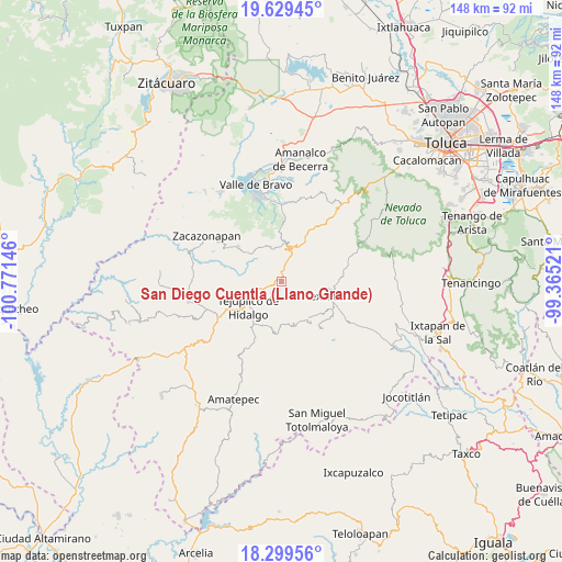
San Diego Cuentla (Llano Grande) GPS coordinates[2]
18° 57' 56.988" North, 100° 4' 5.988" West
| Map corner | latitude | longitude |
|---|---|---|
| Upper-left | 19.62945°, | -100.77146° |
| Center: | 18.96583°, | -100.06833° |
| Lower-right: | 18.29956°, | -99.36521° |
| Map W x H: | 147.9×147.9 km | = 91.9×91.9mi |
| max Lat: | 32.7° ⇑65.5% North |
| San Diego Cuentla (Llano Grande): | 18.96583° |
| min Lat: | ⇓34.5% South 14.53588° |
| min Long | San Diego Cuent | max Long |
| -117.105° | -100.06833° | -86.73105° |
| W 35.2%⇐ | ⇒64.8% E |
Elevation
Elevation of San Diego Cuentla (Llano Grande) is 1728 m = 5669 ft, and this is 474.3 m = 1556 ft above average elevation for this country.
| Max E: |
3497 m = 11473 ft | 39.8% |
| San Diego Cuentla (Llano Grande) | 1728 m 5669 ft | |
| Avg. | 1253.7 m = 4113 ft | |
Min E: |
-1 m = -3 ft | 60.2% |
See also: Mexico elevation on elevation.city.
Geographical zone
San Diego Cuentla (Llano Grande) is located in North Torrid zone (between Equator and Tropic of Cancer). Distance of this Northern Tropic circle is 497.1 km =308.9 mi to North.| Distance of | km | miles | from San Diego Cuentla (Llano Grande) |
|---|---|---|---|
| North Pole | 7898.3 | 4907.8 | to North |
| Arctic Circle | 5292.4 | 3288.5 | to North |
| Tropic Cancer | 497.1 | 308.9 | to North |
| Equator | 2108.8 | 1310.3 | to South |


Nearby cities:
15 places around San Diego Cuentla (Llano Grande): (largest is in red/bold)
• Almoloya de las Granadas
6.7 km =4.2 mi,  273°
273°
• Barrio San José (Barrio Tecolote)
9.9 km =6.2 mi,  49°
49°
• Colonia Buenavista Primera Sección
11 km =6.8 mi,  238°
238°
• El Peñón
10.3 km =6.4 mi,  333°
333°
• Estancia Vieja (San José la Estancia)
6 km =3.7 mi,  30°
30°
• Jalpan (Jalpan San Simón)
11 km =6.8 mi,  246°
246°
• La Labor de Zaragoza
11 km =6.8 mi,  196°
196°
• Rincón de Aguirre
10.3 km =6.4 mi,  224°
224°
• Rincón de Ugarte
9.7 km =6 mi, 243°
• Rincón del Carmen
9 km =5.6 mi, 218°
• San Andrés Ocotepec
7.3 km =4.5 mi,  161°
161°
• San Gabriel Cuentla
1.4 km =0.9 mi,  75°
75°
• San Simón de Guerrero
9.1 km =5.7 mi, 45°
• Temascaltepec de González
9.1 km =5.7 mi,  17°
17°
• Tenería
2.7 km =1.7 mi,  287°
287°
Sources, notices
• [Note1] Compared only with cities in Mexico existing in our database
• [Src1] Map data: © OpenStreetMap contributors (CC-BY-SA)
• [Src2] Other city data from geonames.org with taken over terms of usage.
• [Src3] Geographical zone / Annual Mean Temperature by Robert A. Rohde @ Wikipedia
