Tenería geodata
Tenería (State of Mexico) is a populated place; located in Mexico in America/Mexico_City (GMT-6) time zone. With population of 1,376 people, there are 6307 cities with bigger population in this country. Compared to other cities in Mexico, 65.2% of cities are located further ↑North; 65% of cities are located further →East and 63.2% of cities have lower elevation than Tenería. Note1


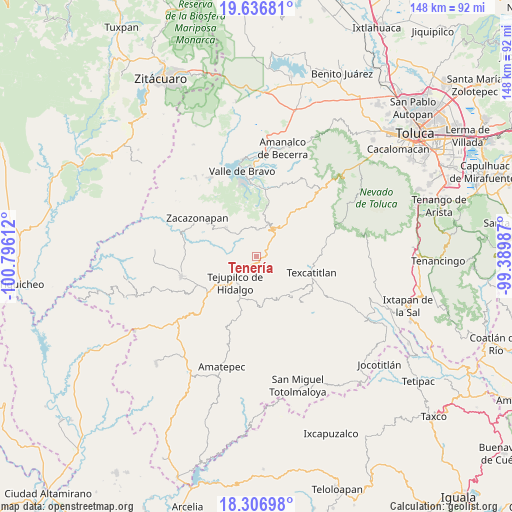
Tenería GPS coordinates[2]
18° 58' 23.592" North, 100° 5' 34.764" West
| Map corner | latitude | longitude |
|---|---|---|
| Upper-left | 19.63681°, | -100.79612° |
| Center: | 18.97322°, | -100.09299° |
| Lower-right: | 18.30698°, | -99.38987° |
| Map W x H: | 147.9×147.9 km | = 91.9×91.9mi |
| max Lat: | 32.7° ⇑65.2% North |
| Tenería: | 18.97322° |
| min Lat: | ⇓34.8% South 14.53588° |
| min Long | Tenería | max Long |
| -117.105° | -100.09299° | -86.73105° |
| W 35%⇐ | ⇒65% E |
Elevation
Elevation of Tenería is 1781 m = 5843 ft, and this is 527.3 m = 1730 ft above average elevation for this country.
| Max E: |
3497 m = 11473 ft | 36.8% |
| Tenería | 1781 m 5843 ft | |
| Avg. | 1253.7 m = 4113 ft | |
Min E: |
-1 m = -3 ft | 63.2% |
See also: Mexico elevation on elevation.city.
Geographical zone
Tenería is located in North Torrid zone (between Equator and Tropic of Cancer). Distance of this Northern Tropic circle is 496.3 km =308.4 mi to North.| Distance of | km | miles | from Tenería |
|---|---|---|---|
| North Pole | 7897.4 | 4907.2 | to North |
| Arctic Circle | 5291.5 | 3288 | to North |
| Tropic Cancer | 496.3 | 308.4 | to North |
| Equator | 2109.6 | 1310.8 | to South |


Nearby cities:
15 places around Tenería: (largest is in red/bold)
• Almoloya de las Granadas
4.1 km =2.5 mi,  265°
265°
• Colonia Buenavista Primera Sección
9.4 km =5.8 mi,  225°
225°
• El Peñón
8.7 km =5.4 mi,  346°
346°
• Estancia Vieja (San José la Estancia)
7.2 km =4.5 mi,  52°
52°
• Jalpan (Jalpan San Simón)
9.1 km =5.7 mi,  235°
235°
• La Albarrada (San Francisco la Albarrada)
10.6 km =6.6 mi,  10°
10°
• Rincón de Aguirre
9.4 km =5.8 mi,  209°
209°
• Rincón de Ugarte
7.9 km =4.9 mi, 229°
• Rincón del Carmen
8.4 km =5.2 mi,  200°
200°
• San Andrés Ocotepec
9.1 km =5.7 mi,  147°
147°
• San Diego Cuentla (Llano Grande)
2.7 km =1.7 mi,  107°
107°
• San Gabriel Cuentla
4 km =2.5 mi,  97°
97°
• San José de la Laguna
8.8 km =5.5 mi,  250°
250°
• Tejupilco de Hidalgo
9.9 km =6.2 mi,  219°
219°
• Temascaltepec de González
9.5 km =5.9 mi,  34°
34°
Sources, notices
• [Note1] Compared only with cities in Mexico existing in our database
• [Src1] Map data: © OpenStreetMap contributors (CC-BY-SA)
• [Src2] Other city data from geonames.org with taken over terms of usage.
• [Src3] Geographical zone / Annual Mean Temperature by Robert A. Rohde @ Wikipedia
