El Peñón geodata
El Peñón (State of Mexico) is a populated place; located in Mexico in America/Mexico_City (GMT-6) time zone. With population of 533 people, there are 15888 cities with bigger population in this country. Compared to other cities in Mexico, 63.9% of cities are located further ↑North; 65.3% of cities are located further →East and 64.7% of cities have lower elevation than El Peñón. Note1


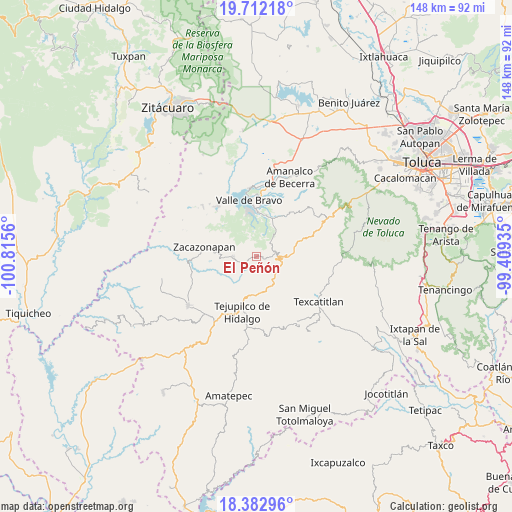
El Peñón GPS coordinates[2]
19° 2' 56.04" North, 100° 6' 44.892" West
| Map corner | latitude | longitude |
|---|---|---|
| Upper-left | 19.71218°, | -100.8156° |
| Center: | 19.0489°, | -100.11247° |
| Lower-right: | 18.38296°, | -99.40935° |
| Map W x H: | 147.8×147.8 km | = 91.8×91.8mi |
| max Lat: | 32.7° ⇑63.9% North |
| El Peñón: | 19.0489° |
| min Lat: | ⇓36.1% South 14.53588° |
| min Long | El Peñón | max Long |
| -117.105° | -100.11247° | -86.73105° |
| W 34.7%⇐ | ⇒65.3% E |
Elevation
Elevation of El Peñón is 1820 m = 5971 ft, and this is 566.3 m = 1858 ft above average elevation for this country.
| Max E: |
3497 m = 11473 ft | 35.3% |
| El Peñón | 1820 m 5971 ft | |
| Avg. | 1253.7 m = 4113 ft | |
Min E: |
-1 m = -3 ft | 64.7% |
See also: Mexico elevation on elevation.city.
Geographical zone
El Peñón is located in North Torrid zone (between Equator and Tropic of Cancer). Distance of this Northern Tropic circle is 487.9 km =303.2 mi to North.| Distance of | km | miles | from El Peñón |
|---|---|---|---|
| North Pole | 7889 | 4902 | to North |
| Arctic Circle | 5283.1 | 3282.8 | to North |
| Tropic Cancer | 487.9 | 303.2 | to North |
| Equator | 2118 | 1316.1 | to South |


Nearby cities:
15 places around El Peñón: (largest is in red/bold)
• Almoloya de las Granadas
9 km =5.6 mi,  193°
193°
• Casas Viejas
11.4 km =7.1 mi,  2°
2°
• Cerro Gordo
9.8 km =6.1 mi,  337°
337°
• Cuadrilla de Dolores
11.1 km =6.9 mi,  24°
24°
• El Potrero de Tenayac
10.5 km =6.5 mi,  266°
266°
• Estancia Vieja (San José la Estancia)
8.7 km =5.4 mi,  117°
117°
• La Albarrada (San Francisco la Albarrada)
4.4 km =2.7 mi,  62°
62°
• La Finca
10.6 km =6.6 mi,  253°
253°
• San Diego Cuentla (Llano Grande)
10.3 km =6.4 mi,  153°
153°
• San Gabriel Cuentla
10.7 km =6.6 mi, 146°
• San Lucas del Pulque
10.6 km =6.6 mi, 56°
• San Pedro Tenayac
6.8 km =4.2 mi, 267°
• San Simón de Guerrero
11.5 km =7.1 mi,  104°
104°
• Temascaltepec de González
7.4 km =4.6 mi,  94°
94°
• Tenería
8.7 km =5.4 mi,  166°
166°
Sources, notices
• [Note1] Compared only with cities in Mexico existing in our database
• [Src1] Map data: © OpenStreetMap contributors (CC-BY-SA)
• [Src2] Other city data from geonames.org with taken over terms of usage.
• [Src3] Geographical zone / Annual Mean Temperature by Robert A. Rohde @ Wikipedia
