Chichilpa geodata
Chichilpa (State of Mexico) is a populated place; located in Mexico in America/Mexico_City (GMT-6) time zone. With population of 720 people, there are 12117 cities with bigger population in this country. Compared to other cities in Mexico, 51% of cities are located further ↓South; 64.5% of cities are located further →East and 98.4% of cities have lower elevation than Chichilpa. Note1


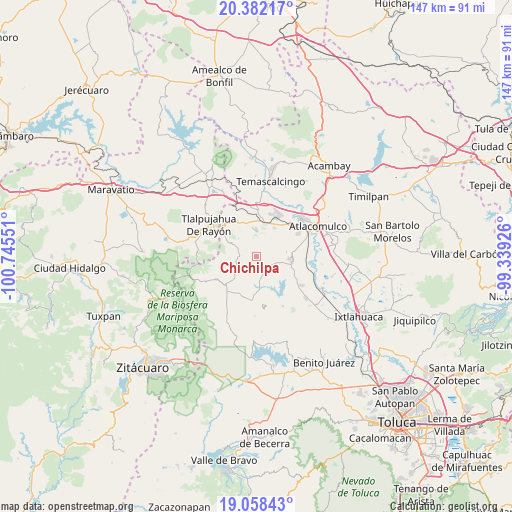
Chichilpa GPS coordinates[2]
19° 43' 18.012" North, 100° 2' 32.568" West
| Map corner | latitude | longitude |
|---|---|---|
| Upper-left | 20.38217°, | -100.74551° |
| Center: | 19.72167°, | -100.04238° |
| Lower-right: | 19.05843°, | -99.33926° |
| Map W x H: | 147.2×147.2 km | = 91.5×91.5mi |
| max Lat: | 32.7° ⇑49% North |
| Chichilpa: | 19.72167° |
| min Lat: | ⇓51% South 14.53588° |
| min Long | Chichilpa | max Long |
| -117.105° | -100.04238° | -86.73105° |
| W 35.5%⇐ | ⇒64.5% E |
Elevation
Elevation of Chichilpa is 2782 m = 9127 ft, and this is 1528.3 m = 5014 ft above average elevation for this country.
| Max E: |
3497 m = 11473 ft | 1.6% |
| Chichilpa | 2782 m 9127 ft | |
| Avg. | 1253.7 m = 4113 ft | |
Min E: |
-1 m = -3 ft | 98.4% |
See also: Mexico elevation on elevation.city.
Geographical zone
Chichilpa is located in North Torrid zone (between Equator and Tropic of Cancer). Distance of this Northern Tropic circle is 413.1 km =256.7 mi to North.| Distance of | km | miles | from Chichilpa |
|---|---|---|---|
| North Pole | 7814.2 | 4855.5 | to North |
| Arctic Circle | 5208.3 | 3236.3 | to North |
| Tropic Cancer | 413.1 | 256.7 | to North |
| Equator | 2192.8 | 1362.5 | to South |


Nearby cities:
15 places around Chichilpa: (largest is in red/bold)
• Barrio San Francisco Ejido de San Pablo Tlalchichilpa
3.7 km =2.3 mi,  65°
65°
• Barrio Santa Cruz de San Pablo Tlalchichilpa
6.4 km =4 mi,  102°
102°
• Barrio la Mesa, Rioyos Buenavista
2.5 km =1.6 mi,  220°
220°
• Dotegiare
1.6 km =1 mi,  184°
184°
• Endotejiare
7.2 km =4.5 mi,  9°
9°
• Guarda de Guadalupe
4 km =2.5 mi,  301°
301°
• Jesús Carranza
6.3 km =3.9 mi,  251°
251°
• La Magdalena Morelos
6.2 km =3.9 mi, 7°
• Pata de Mula de los Cedros (Patemula)
6.8 km =4.2 mi,  283°
283°
• Pueblo Nuevo de los Ángeles
7 km =4.3 mi,  30°
30°
• Purísima Concepción Mayorazgo
5.4 km =3.4 mi,  128°
128°
• Rincón de los Pirules
2.3 km =1.4 mi, 32°
• San Francisco Solo
5.2 km =3.2 mi,  266°
266°
• San Miguel del Centro
6.9 km =4.3 mi, 269°
• Santa Rita de la Cuesta
4.2 km =2.6 mi,  314°
314°
Sources, notices
• [Note1] Compared only with cities in Mexico existing in our database
• [Src1] Map data: © OpenStreetMap contributors (CC-BY-SA)
• [Src2] Other city data from geonames.org with taken over terms of usage.
• [Src3] Geographical zone / Annual Mean Temperature by Robert A. Rohde @ Wikipedia
