San Miguel del Centro geodata
San Miguel del Centro (State of Mexico) is a populated place; located in Mexico in America/Mexico_City (GMT-6) time zone. With population of 1,741 people, there are 4986 cities with bigger population in this country. Compared to other cities in Mexico, 50.9% of cities are located further ↓South; 65.3% of cities are located further →East and 99.5% of cities have lower elevation than San Miguel del Centro. Note1
Current local time in San Miguel del Centro:
06:45 AM, WednesdayDifference from your time zone: hours


San Miguel del Centro GPS coordinates[2]
19° 43' 14.412" North, 100° 6' 31.5" West
| Map corner | latitude | longitude |
|---|---|---|
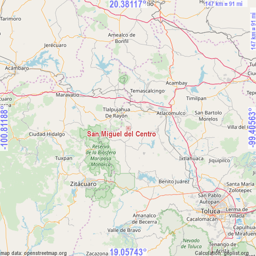
| Upper-left | 20.38117°, | -100.81188° |
| Center: | 19.72067°, | -100.10875° |
| Lower-right: | 19.05743°, | -99.40563° |
| Map W x H: | 147.2×147.2 km | = 91.5×91.5mi |
| max Lat: | 32.7° ⇑49.1% North |
| San Miguel del Centro: | 19.72067° |
| min Lat: | ⇓50.9% South 14.53588° |
| min Long | San Miguel del | max Long |
| -117.105° | -100.10875° | -86.73105° |
| W 34.7%⇐ | ⇒65.3% E |
Elevation
Elevation of San Miguel del Centro is 2910 m = 9547 ft, and this is 1656.3 m = 5434 ft above average elevation for this country.
| Max E: |
3497 m = 11473 ft | 0.5% |
| San Miguel del Centro | 2910 m 9547 ft | |
| Avg. | 1253.7 m = 4113 ft | |
Min E: |
-1 m = -3 ft | 99.5% |
See also: Mexico elevation on elevation.city.
Geographical zone
San Miguel del Centro is located in North Torrid zone (between Equator and Tropic of Cancer). Distance of this Northern Tropic circle is 413.2 km =256.8 mi to North.| Distance of | km | miles | from San Miguel del Centro |
|---|---|---|---|
| North Pole | 7814.3 | 4855.6 | to North |
| Arctic Circle | 5208.4 | 3236.3 | to North |
| Tropic Cancer | 413.2 | 256.8 | to North |
| Equator | 2192.7 | 1362.5 | to South |


Nearby cities:
15 places around San Miguel del Centro: (largest is in red/bold)
• Barrio del Gigante
5.3 km =3.3 mi,  15°
15°
• Barrio la Mesa, Rioyos Buenavista
5.7 km =3.5 mi,  108°
108°
• Cedro de la Manzana
3.3 km =2.1 mi,  194°
194°
• Cerro Llorón
5.1 km =3.2 mi,  345°
345°
• Concepción la Venta
5.6 km =3.5 mi,  234°
234°
• El Salto la Venta (Barrio el Salto)
3.9 km =2.4 mi,  235°
235°
• Fábrica Pueblo Nuevo
6.2 km =3.9 mi,  222°
222°
• Guadalupe del Pedregal la Palma
4.9 km =3 mi,  183°
183°
• Guarda de Guadalupe
4.2 km =2.6 mi,  57°
57°
• Jesús Carranza
2.1 km =1.3 mi,  153°
153°
• Pata de Mula de los Cedros (Patemula)
1.7 km =1.1 mi,  11°
11°
• Presa Brockman
6.3 km =3.9 mi,  326°
326°
• San Francisco Solo
1.7 km =1.1 mi,  97°
97°
• Santa Cruz del Rincón
6 km =3.7 mi, 184°
• Santa Rita de la Cuesta
5 km =3.1 mi,  52°
52°
Sources, notices
• [Note1] Compared only with cities in Mexico existing in our database
• [Src1] Map data: © OpenStreetMap contributors (CC-BY-SA)
• [Src2] Other city data from geonames.org with taken over terms of usage.
• [Src3] Geographical zone / Annual Mean Temperature by Robert A. Rohde @ Wikipedia
