Jesús Carranza geodata
Jesús Carranza (State of Mexico) is a populated place; located in Mexico in America/Mexico_City (GMT-6) time zone. With population of 527 people, there are 16037 cities with bigger population in this country. Compared to other cities in Mexico, 50.5% of cities are located further ↓South; 65.1% of cities are located further →East and 97.3% of cities have lower elevation than Jesús Carranza. Note1


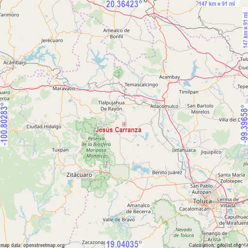
Jesús Carranza GPS coordinates[2]
19° 42' 13.176" North, 100° 5' 58.92" West
| Map corner | latitude | longitude |
|---|---|---|
| Upper-left | 20.36423°, | -100.80283° |
| Center: | 19.70366°, | -100.0997° |
| Lower-right: | 19.04035°, | -99.39658° |
| Map W x H: | 147.2×147.2 km | = 91.5×91.5mi |
| max Lat: | 32.7° ⇑49.5% North |
| Jesús Carranza: | 19.70366° |
| min Lat: | ⇓50.5% South 14.53588° |
| min Long | Jesús Carranza | max Long |
| -117.105° | -100.0997° | -86.73105° |
| W 34.9%⇐ | ⇒65.1% E |
Elevation
Elevation of Jesús Carranza is 2701 m = 8862 ft, and this is 1447.3 m = 4748 ft above average elevation for this country.
| Max E: |
3497 m = 11473 ft | 2.7% |
| Jesús Carranza | 2701 m 8862 ft | |
| Avg. | 1253.7 m = 4113 ft | |
Min E: |
-1 m = -3 ft | 97.3% |
See also: Mexico elevation on elevation.city.
Geographical zone
Jesús Carranza is located in North Torrid zone (between Equator and Tropic of Cancer). Distance of this Northern Tropic circle is 415.1 km =257.9 mi to North.| Distance of | km | miles | from Jesús Carranza |
|---|---|---|---|
| North Pole | 7816.2 | 4856.8 | to North |
| Arctic Circle | 5210.3 | 3237.5 | to North |
| Tropic Cancer | 415.1 | 257.9 | to North |
| Equator | 2190.8 | 1361.3 | to South |


Nearby cities:
15 places around Jesús Carranza: (largest is in red/bold)
• Barrio la Mesa, Rioyos Buenavista
4.4 km =2.7 mi,  88°
88°
• Cedro de la Manzana
2.2 km =1.4 mi,  234°
234°
• Chichilpa
6.3 km =3.9 mi,  71°
71°
• Concepción la Venta
5.6 km =3.5 mi,  256°
256°
• Dotegiare
5.9 km =3.7 mi, 86°
• El Salto la Venta (Barrio el Salto)
4.1 km =2.5 mi,  265°
265°
• El Valerio
5.8 km =3.6 mi,  179°
179°
• Fábrica Pueblo Nuevo
5.8 km =3.6 mi,  242°
242°
• Guadalupe del Pedregal la Palma
3.2 km =2 mi,  203°
203°
• Guarda de Guadalupe
4.9 km =3 mi,  32°
32°
• Pata de Mula de los Cedros (Patemula)
3.6 km =2.2 mi,  350°
350°
• San Francisco Solo
1.9 km =1.2 mi, 25°
• San Miguel del Centro
2.1 km =1.3 mi,  333°
333°
• Santa Cruz del Rincón
4.3 km =2.7 mi, 199°
• Santa Rita de la Cuesta
5.8 km =3.6 mi, 31°
Sources, notices
• [Note1] Compared only with cities in Mexico existing in our database
• [Src1] Map data: © OpenStreetMap contributors (CC-BY-SA)
• [Src2] Other city data from geonames.org with taken over terms of usage.
• [Src3] Geographical zone / Annual Mean Temperature by Robert A. Rohde @ Wikipedia
