La Esperanza geodata
La Esperanza (State of Mexico) is a populated place; located in Mexico in America/Mexico_City (GMT-6) time zone. With population of 962 people, there are 9047 cities with bigger population in this country. Compared to other cities in Mexico, 51.6% of cities are located further ↑North; 66% of cities are located further →East and 99.5% of cities have lower elevation than La Esperanza. Note1


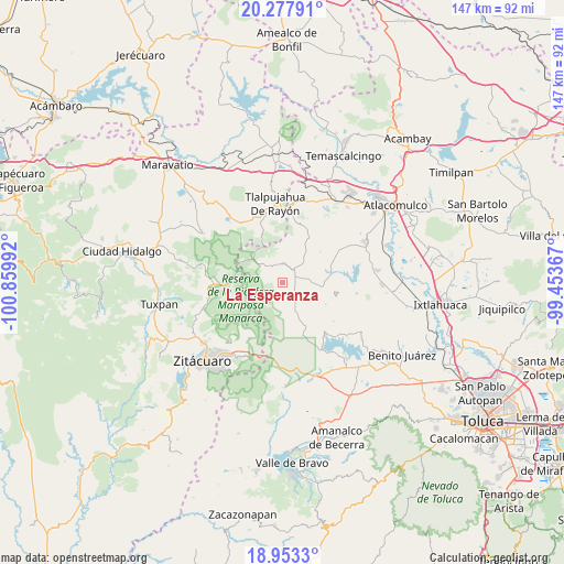
La Esperanza GPS coordinates[2]
19° 37' 1.092" North, 100° 9' 24.444" West
| Map corner | latitude | longitude |
|---|---|---|
| Upper-left | 20.27791°, | -100.85992° |
| Center: | 19.61697°, | -100.15679° |
| Lower-right: | 18.9533°, | -99.45367° |
| Map W x H: | 147.3×147.3 km | = 91.5×91.5mi |
| max Lat: | 32.7° ⇑51.6% North |
| La Esperanza: | 19.61697° |
| min Lat: | ⇓48.4% South 14.53588° |
| min Long | La Esperanza | max Long |
| -117.105° | -100.15679° | -86.73105° |
| W 34%⇐ | ⇒66% E |
Elevation
Elevation of La Esperanza is 2909 m = 9544 ft, and this is 1655.3 m = 5431 ft above average elevation for this country.
| Max E: |
3497 m = 11473 ft | 0.5% |
| La Esperanza | 2909 m 9544 ft | |
| Avg. | 1253.7 m = 4113 ft | |
Min E: |
-1 m = -3 ft | 99.5% |
See also: Mexico elevation on elevation.city.
Geographical zone
La Esperanza is located in North Torrid zone (between Equator and Tropic of Cancer). Distance of this Northern Tropic circle is 424.7 km =263.9 mi to North.| Distance of | km | miles | from La Esperanza |
|---|---|---|---|
| North Pole | 7825.9 | 4862.8 | to North |
| Arctic Circle | 5220 | 3243.6 | to North |
| Tropic Cancer | 424.7 | 263.9 | to North |
| Equator | 2181.2 | 1355.3 | to South |


Nearby cities:
15 places around La Esperanza: (largest is in red/bold)
• Barrio San Joaquín Lamillas (San José Lamillas)
6.4 km =4 mi,  170°
170°
• Concepción del Monte
3.8 km =2.4 mi,  3°
3°
• Ejido la Soledad
6.1 km =3.8 mi,  59°
59°
• El Huizache
2.9 km =1.8 mi,  206°
206°
• Fábrica Concepción
2.9 km =1.8 mi,  48°
48°
• Fábrica Pueblo Nuevo
7 km =4.3 mi,  6°
6°
• Guadalupe Buenavista
3.1 km =1.9 mi,  100°
100°
• Guadalupe Chico
3.2 km =2 mi,  131°
131°
• La Chispa
6.8 km =4.2 mi, 166°
• La Mesa
3.7 km =2.3 mi, 208°
• La Trampa
5.5 km =3.4 mi,  194°
194°
• Rincón de Lijadero
4.6 km =2.9 mi,  216°
216°
• San Felipe de Jesús
4.8 km =3 mi,  290°
290°
• San José del Rincón Centro
5 km =3.1 mi, 4°
• Santa Cruz del Rincón
7.2 km =4.5 mi,  39°
39°
Sources, notices
• [Note1] Compared only with cities in Mexico existing in our database
• [Src1] Map data: © OpenStreetMap contributors (CC-BY-SA)
• [Src2] Other city data from geonames.org with taken over terms of usage.
• [Src3] Geographical zone / Annual Mean Temperature by Robert A. Rohde @ Wikipedia
