El Huizache geodata
El Huizache (State of Mexico) is a populated place; located in Mexico in America/Mexico_City (GMT-6) time zone. With population of 903 people, there are 9658 cities with bigger population in this country. Compared to other cities in Mexico, 52% of cities are located further ↑North; 66.1% of cities are located further →East and 99.1% of cities have lower elevation than El Huizache. Note1


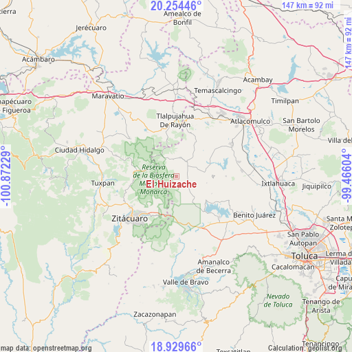
El Huizache GPS coordinates[2]
19° 35' 36.312" North, 100° 10' 8.976" West
| Map corner | latitude | longitude |
|---|---|---|
| Upper-left | 20.25446°, | -100.87229° |
| Center: | 19.59342°, | -100.16916° |
| Lower-right: | 18.92966°, | -99.46604° |
| Map W x H: | 147.3×147.3 km | = 91.5×91.5mi |
| max Lat: | 32.7° ⇑52% North |
| El Huizache: | 19.59342° |
| min Lat: | ⇓48% South 14.53588° |
| min Long | El Huizache | max Long |
| -117.105° | -100.16916° | -86.73105° |
| W 33.9%⇐ | ⇒66.1% E |
Elevation
Elevation of El Huizache is 2850 m = 9350 ft, and this is 1596.3 m = 5237 ft above average elevation for this country.
| Max E: |
3497 m = 11473 ft | 0.90000000000001% |
| El Huizache | 2850 m 9350 ft | |
| Avg. | 1253.7 m = 4113 ft | |
Min E: |
-1 m = -3 ft | 99.1% |
See also: Mexico elevation on elevation.city.
Geographical zone
El Huizache is located in North Torrid zone (between Equator and Tropic of Cancer). Distance of this Northern Tropic circle is 427.3 km =265.5 mi to North.| Distance of | km | miles | from El Huizache |
|---|---|---|---|
| North Pole | 7828.5 | 4864.4 | to North |
| Arctic Circle | 5222.6 | 3245.2 | to North |
| Tropic Cancer | 427.3 | 265.5 | to North |
| Equator | 2178.6 | 1353.7 | to South |


Nearby cities:
15 places around El Huizache: (largest is in red/bold)
• Barrio San Joaquín Lamillas (San José Lamillas)
4.3 km =2.7 mi,  148°
148°
• Barrio Santa Juanita el Depósito
7 km =4.3 mi,  139°
139°
• Concepción del Monte
6.6 km =4.1 mi,  13°
13°
• El Puente
6.3 km =3.9 mi, 138°
• Fábrica Concepción
5.7 km =3.5 mi,  37°
37°
• Guadalupe Buenavista
4.9 km =3 mi,  64°
64°
• Guadalupe Chico
3.7 km =2.3 mi,  82°
82°
• La Chispa
4.9 km =3 mi, 144°
• La Esperanza
2.9 km =1.8 mi,  26°
26°
• La Mesa
0.8 km =0.5 mi,  215°
215°
• La Trampa
2.7 km =1.7 mi,  182°
182°
• Las Rosas
5.3 km =3.3 mi,  169°
169°
• Los Lobos Segunda Sección
7 km =4.3 mi,  126°
126°
• Rincón de Lijadero
1.8 km =1.1 mi,  232°
232°
• San Felipe de Jesús
5.3 km =3.3 mi,  323°
323°
Sources, notices
• [Note1] Compared only with cities in Mexico existing in our database
• [Src1] Map data: © OpenStreetMap contributors (CC-BY-SA)
• [Src2] Other city data from geonames.org with taken over terms of usage.
• [Src3] Geographical zone / Annual Mean Temperature by Robert A. Rohde @ Wikipedia
