Guadalupe Buenavista geodata
Guadalupe Buenavista (State of Mexico) is a populated place; located in Mexico in America/Mexico_City (GMT-6) time zone. With population of 1,016 people, there are 8570 cities with bigger population in this country. Compared to other cities in Mexico, 51.6% of cities are located further ↑North; 65.5% of cities are located further →East and 97.3% of cities have lower elevation than Guadalupe Buenavista. Note1
Current local time in Guadalupe Buenavista:
08:26 AM, WednesdayDifference from your time zone: hours


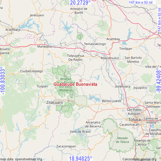
Guadalupe Buenavista GPS coordinates[2]
19° 36' 42.984" North, 100° 7' 37.92" West
| Map corner | latitude | longitude |
|---|---|---|
| Upper-left | 20.2729°, | -100.83033° |
| Center: | 19.61194°, | -100.1272° |
| Lower-right: | 18.94825°, | -99.42408° |
| Map W x H: | 147.3×147.3 km | = 91.5×91.5mi |
| max Lat: | 32.7° ⇑51.6% North |
| Guadalupe Buenavista: | 19.61194° |
| min Lat: | ⇓48.4% South 14.53588° |
| min Long | Guadalupe Buena | max Long |
| -117.105° | -100.1272° | -86.73105° |
| W 34.5%⇐ | ⇒65.5% E |
Elevation
Elevation of Guadalupe Buenavista is 2700 m = 8858 ft, and this is 1446.3 m = 4745 ft above average elevation for this country.
| Max E: |
3497 m = 11473 ft | 2.7% |
| Guadalupe Buenavista | 2700 m 8858 ft | |
| Avg. | 1253.7 m = 4113 ft | |
Min E: |
-1 m = -3 ft | 97.3% |
See also: Mexico elevation on elevation.city.
Geographical zone
Guadalupe Buenavista is located in North Torrid zone (between Equator and Tropic of Cancer). Distance of this Northern Tropic circle is 425.3 km =264.3 mi to North.| Distance of | km | miles | from Guadalupe Buenavista |
|---|---|---|---|
| North Pole | 7826.4 | 4863.1 | to North |
| Arctic Circle | 5220.5 | 3243.9 | to North |
| Tropic Cancer | 425.3 | 264.3 | to North |
| Equator | 2180.6 | 1355 | to South |


Nearby cities:
15 places around Guadalupe Buenavista: (largest is in red/bold)
• Barrio San Joaquín Lamillas (San José Lamillas)
6.1 km =3.8 mi,  200°
200°
• Concepción del Monte
5.2 km =3.2 mi,  326°
326°
• Ejido la Soledad
4.3 km =2.7 mi,  30°
30°
• El Huizache
4.9 km =3 mi,  244°
244°
• El Valerio
5.3 km =3.3 mi, 33°
• Fábrica Concepción
2.7 km =1.7 mi,  339°
339°
• Guadalupe Chico
1.7 km =1.1 mi, 204°
• La Chispa
6.2 km =3.9 mi,  194°
194°
• La Esperanza
3.1 km =1.9 mi,  280°
280°
• La Mesa
5.6 km =3.5 mi, 240°
• Loma del Rancho
5.5 km =3.4 mi,  104°
104°
• Los Lobos Segunda Sección
6.3 km =3.9 mi,  168°
168°
• San José del Rincón Centro
6.2 km =3.9 mi, 334°
• San Miguel Agua Bendita
5.4 km =3.4 mi,  67°
67°
• Santa Cruz del Rincón
6.3 km =3.9 mi,  13°
13°
Sources, notices
• [Note1] Compared only with cities in Mexico existing in our database
• [Src1] Map data: © OpenStreetMap contributors (CC-BY-SA)
• [Src2] Other city data from geonames.org with taken over terms of usage.
• [Src3] Geographical zone / Annual Mean Temperature by Robert A. Rohde @ Wikipedia
