El Terrero geodata
El Terrero (Guerrero) is a populated place; located in Mexico in America/Mexico_City (GMT-6) time zone. With population of 1,490 people, there are 5789 cities with bigger population in this country. Compared to other cities in Mexico, 77.2% of cities are located further ↑North; 67.6% of cities are located further →East and 72.5% of cities have higher elevation than El Terrero. Note1


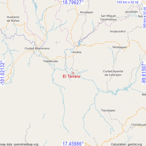
El Terrero GPS coordinates[2]
18° 7' 45.624" North, 100° 19' 5.484" West
| Map corner | latitude | longitude |
|---|---|---|
| Upper-left | 18.79627°, | -101.02132° |
| Center: | 18.12934°, | -100.31819° |
| Lower-right: | 17.45986°, | -99.61507° |
| Map W x H: | 148.6×148.6 km | = 92.3×92.3mi |
| max Lat: | 32.7° ⇑77.2% North |
| El Terrero: | 18.12934° |
| min Lat: | ⇓22.8% South 14.53588° |
| min Long | El Terrero | max Long |
| -117.105° | -100.31819° | -86.73105° |
| W 32.4%⇐ | ⇒67.6% E |
Elevation
Elevation of El Terrero is 313 m = 1027 ft, and this is 940.7 m = 3086 ft below average elevation for this country.
| Max E: |
3497 m = 11473 ft | 72.5% |
| Avg. | 1253.7 m = 4113 ft | |
| El Terrero | 313 m = 1027 ft | |
Min E: |
-1 m = -3 ft | 27.5% |
See also: Mexico elevation on elevation.city.
Geographical zone
El Terrero is located in North Torrid zone (between Equator and Tropic of Cancer). Distance of this Northern Tropic circle is 590.1 km =366.7 mi to North.| Distance of | km | miles | from El Terrero |
|---|---|---|---|
| North Pole | 7991.3 | 4965.6 | to North |
| Arctic Circle | 5385.4 | 3346.3 | to North |
| Tropic Cancer | 590.1 | 366.7 | to North |
| Equator | 2015.8 | 1252.6 | to South |


Nearby cities:
15 places around El Terrero: (largest is in red/bold)
• Ajuchitlán del Progreso
17.6 km =10.9 mi,  278°
278°
• El Aguaje
8.5 km =5.3 mi,  329°
329°
• El Escondido
10.2 km =6.3 mi,  3°
3°
• El Guayabo
5.4 km =3.4 mi,  52°
52°
• El Remance
5.6 km =3.5 mi,  343°
343°
• La Laja
17.7 km =11 mi,  259°
259°
• Las Juntas
8.8 km =5.5 mi,  316°
316°
• San Antonio de la Gavia
6.8 km =4.2 mi,  254°
254°
• San Bartolo
12.4 km =7.7 mi, 326°
• San José Poliutla
17.7 km =11 mi, 334°
• San Miguel Totolapan
8.4 km =5.2 mi,  294°
294°
• Santo Niño
17.5 km =10.9 mi,  357°
357°
• Valle Galeana (El Tamarindo)
8.4 km =5.2 mi,  89°
89°
• Valle Luz
2.3 km =1.4 mi,  273°
273°
• Villa Hidalgo (El Cubo)
3.6 km =2.2 mi,  5°
5°
Sources, notices
• [Note1] Compared only with cities in Mexico existing in our database
• [Src1] Map data: © OpenStreetMap contributors (CC-BY-SA)
• [Src2] Other city data from geonames.org with taken over terms of usage.
• [Src3] Geographical zone / Annual Mean Temperature by Robert A. Rohde @ Wikipedia
