Santo Niño geodata
Santo Niño (Guerrero) is a populated place; located in Mexico in America/Mexico_City (GMT-6) time zone. With population of 923 people, there are 9459 cities with bigger population in this country. Compared to other cities in Mexico, 75.1% of cities are located further ↑North; 67.7% of cities are located further →East and 70.7% of cities have higher elevation than Santo Niño. Note1


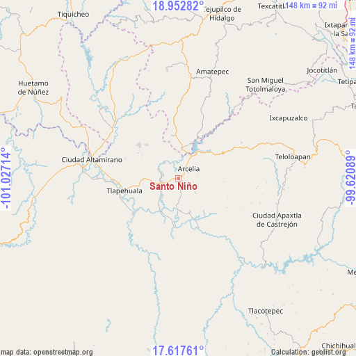
Santo Niño GPS coordinates[2]
18° 17' 11.4" North, 100° 19' 26.436" West
| Map corner | latitude | longitude |
|---|---|---|
| Upper-left | 18.95282°, | -101.02714° |
| Center: | 18.2865°, | -100.32401° |
| Lower-right: | 17.61761°, | -99.62089° |
| Map W x H: | 148.5×148.5 km | = 92.3×92.3mi |
| max Lat: | 32.7° ⇑75.1% North |
| Santo Niño: | 18.2865° |
| min Lat: | ⇓24.9% South 14.53588° |
| min Long | Santo Niño | max Long |
| -117.105° | -100.32401° | -86.73105° |
| W 32.3%⇐ | ⇒67.7% E |
Elevation
Elevation of Santo Niño is 383 m = 1257 ft, and this is 870.7 m = 2857 ft below average elevation for this country.
| Max E: |
3497 m = 11473 ft | 70.7% |
| Avg. | 1253.7 m = 4113 ft | |
| Santo Niño | 383 m = 1257 ft | |
Min E: |
-1 m = -3 ft | 29.3% |
See also: Mexico elevation on elevation.city.
Geographical zone
Santo Niño is located in North Torrid zone (between Equator and Tropic of Cancer). Distance of this Northern Tropic circle is 572.7 km =355.9 mi to North.| Distance of | km | miles | from Santo Niño |
|---|---|---|---|
| North Pole | 7973.8 | 4954.7 | to North |
| Arctic Circle | 5367.9 | 3335.5 | to North |
| Tropic Cancer | 572.7 | 355.9 | to North |
| Equator | 2033.3 | 1263.4 | to South |


Nearby cities:
15 places around Santo Niño: (largest is in red/bold)
• Arcelia
5.7 km =3.5 mi,  51°
51°
• Colonia Emperador Cuauhtémoc
3.3 km =2.1 mi,  74°
74°
• Cuauhlotitlán
6.6 km =4.1 mi,  355°
355°
• El Aguaje
10.8 km =6.7 mi,  200°
200°
• El Escondido
7.4 km =4.6 mi,  170°
170°
• El Naranjo
11.2 km =7 mi,  18°
18°
• El Remance
12.1 km =7.5 mi,  184°
184°
• El Temblor
11.8 km =7.3 mi,  7°
7°
• Las Juntas
12.4 km =7.7 mi,  206°
206°
• Nuevo Copaltepec
11.6 km =7.2 mi, 19°
• Palos Altos
10.7 km =6.6 mi,  29°
29°
• Reforma de Lázaro Cárdenas (El Aterrizaje)
4.1 km =2.5 mi,  79°
79°
• San Bartolo
9.5 km =5.9 mi,  221°
221°
• San José Poliutla
7.2 km =4.5 mi,  258°
258°
• San Miguel Tecomatlán
9 km =5.6 mi,  293°
293°
Sources, notices
• [Note1] Compared only with cities in Mexico existing in our database
• [Src1] Map data: © OpenStreetMap contributors (CC-BY-SA)
• [Src2] Other city data from geonames.org with taken over terms of usage.
• [Src3] Geographical zone / Annual Mean Temperature by Robert A. Rohde @ Wikipedia
