El Aguaje geodata
El Aguaje (Guerrero) is a populated place; located in Mexico in America/Mexico_City (GMT-6) time zone. With population of 657 people, there are 13209 cities with bigger population in this country. Compared to other cities in Mexico, 76.3% of cities are located further ↑North; 68% of cities are located further →East and 72.7% of cities have higher elevation than El Aguaje. Note1


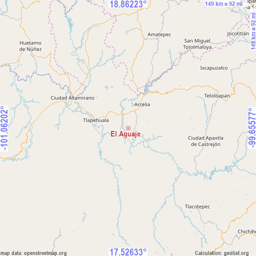
El Aguaje GPS coordinates[2]
18° 11' 44.016" North, 100° 21' 32.004" West
| Map corner | latitude | longitude |
|---|---|---|
| Upper-left | 18.86223°, | -101.06202° |
| Center: | 18.19556°, | -100.35889° |
| Lower-right: | 17.52633°, | -99.65577° |
| Map W x H: | 148.5×148.5 km | = 92.3×92.3mi |
| max Lat: | 32.7° ⇑76.3% North |
| El Aguaje: | 18.19556° |
| min Lat: | ⇓23.7% South 14.53588° |
| min Long | El Aguaje | max Long |
| -117.105° | -100.35889° | -86.73105° |
| W 32%⇐ | ⇒68% E |
Elevation
Elevation of El Aguaje is 303 m = 994 ft, and this is 950.7 m = 3119 ft below average elevation for this country.
| Max E: |
3497 m = 11473 ft | 72.7% |
| Avg. | 1253.7 m = 4113 ft | |
| El Aguaje | 303 m = 994 ft | |
Min E: |
-1 m = -3 ft | 27.3% |
See also: Mexico elevation on elevation.city.
Geographical zone
El Aguaje is located in North Torrid zone (between Equator and Tropic of Cancer). Distance of this Northern Tropic circle is 582.8 km =362.1 mi to North.| Distance of | km | miles | from El Aguaje |
|---|---|---|---|
| North Pole | 7983.9 | 4961 | to North |
| Arctic Circle | 5378 | 3341.7 | to North |
| Tropic Cancer | 582.8 | 362.1 | to North |
| Equator | 2023.2 | 1257.2 | to South |


Nearby cities:
15 places around El Aguaje: (largest is in red/bold)
• Colonia Emperador Cuauhtémoc
13 km =8.1 mi,  32°
32°
• El Escondido
5.7 km =3.5 mi,  60°
60°
• El Guayabo
9.5 km =5.9 mi,  115°
115°
• El Remance
3.3 km =2.1 mi,  126°
126°
• El Terrero
8.5 km =5.3 mi,  149°
149°
• Las Juntas
2.1 km =1.3 mi,  239°
239°
• Reforma de Lázaro Cárdenas (El Aterrizaje)
13.3 km =8.3 mi,  35°
35°
• San Antonio de la Gavia
9.4 km =5.8 mi,  193°
193°
• San Bartolo
4 km =2.5 mi,  318°
318°
• San Cristóbal
13.8 km =8.6 mi,  258°
258°
• San José Poliutla
9.3 km =5.8 mi,  338°
338°
• San Miguel Totolapan
5.1 km =3.2 mi,  221°
221°
• Santo Niño
10.8 km =6.7 mi,  20°
20°
• Valle Luz
7.5 km =4.7 mi,  164°
164°
• Villa Hidalgo (El Cubo)
6 km =3.7 mi, 129°
Sources, notices
• [Note1] Compared only with cities in Mexico existing in our database
• [Src1] Map data: © OpenStreetMap contributors (CC-BY-SA)
• [Src2] Other city data from geonames.org with taken over terms of usage.
• [Src3] Geographical zone / Annual Mean Temperature by Robert A. Rohde @ Wikipedia
