El Colomo geodata
El Colomo (Jalisco) is a populated place; located in Mexico in America/Mazatlan (GMT-7) time zone. With population of 1,476 people, there are 5851 cities with bigger population in this country. Compared to other cities in Mexico, 74.3% of cities are located further ↓South; 92.2% of cities are located further →East and 82.9% of cities have higher elevation than El Colomo. Note1


El Colomo GPS coordinates[2]
20° 52' 10.632" North, 105° 9' 21.492" West
| Map corner | latitude | longitude |
|---|---|---|
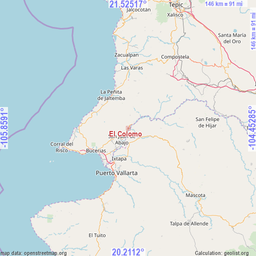
| Upper-left | 21.52517°, | -105.8591° |
| Center: | 20.86962°, | -105.15597° |
| Lower-right: | 20.2112°, | -104.45285° |
| Map W x H: | 146.1×146.1 km | = 90.8×90.8mi |
| max Lat: | 32.7° ⇑25.7% North |
| El Colomo: | 20.86962° |
| min Lat: | ⇓74.3% South 14.53588° |
| min Long | El Colomo | max Long |
| -117.105° | -105.15597° | -86.73105° |
| W 7.8%⇐ | ⇒92.2% E |
Elevation
Elevation of El Colomo is 61 m = 200 ft, and this is 1192.7 m = 3913 ft below average elevation for this country.
| Max E: |
3497 m = 11473 ft | 82.9% |
| Avg. | 1253.7 m = 4113 ft | |
| El Colomo | 61 m = 200 ft | |
Min E: |
-1 m = -3 ft | 17.1% |
See also: Mexico elevation on elevation.city.
Geographical zone
El Colomo is located in North Torrid zone (between Equator and Tropic of Cancer). Distance of this Northern Tropic circle is 285.4 km =177.3 mi to North.| Distance of | km | miles | from El Colomo |
|---|---|---|---|
| North Pole | 7686.6 | 4776.2 | to North |
| Arctic Circle | 5080.7 | 3157 | to North |
| Tropic Cancer | 285.4 | 177.3 | to North |
| Equator | 2320.5 | 1441.9 | to South |


Nearby cities:
15 places around El Colomo: (largest is in red/bold)
• Aguamilpa
14.3 km =8.9 mi,  66°
66°
• Banus Vallarta (Verde Vallarta)
18.4 km =11.4 mi,  202°
202°
• El Colorado
11 km =6.8 mi,  180°
180°
• El Porvenir
15.7 km =9.8 mi,  214°
214°
• El Ranchito
15.2 km =9.4 mi, 177°
• El Zancudo
10 km =6.2 mi, 178°
• Ixtapa
17.8 km =11.1 mi, 196°
• La Desembocada
15.6 km =9.7 mi, 179°
• San Clemente de Lima
19 km =11.8 mi,  219°
219°
• San José del Valle
14 km =8.7 mi, 212°
• San Juan de Abajo
7.1 km =4.4 mi, 211°
• San Vicente
16.6 km =10.3 mi, 216°
• Tebelchia
2.6 km =1.6 mi,  108°
108°
• Tondoroque
20 km =12.4 mi,  226°
226°
• Valle de Banderas
11.8 km =7.3 mi, 234°
Sources, notices
• [Note1] Compared only with cities in Mexico existing in our database
• [Src1] Map data: © OpenStreetMap contributors (CC-BY-SA)
• [Src2] Other city data from geonames.org with taken over terms of usage.
• [Src3] Geographical zone / Annual Mean Temperature by Robert A. Rohde @ Wikipedia
