Plan de Ayala geodata
Plan de Ayala (Tamaulipas) is a populated place; located in Mexico in America/Monterrey (GMT-6) time zone. With population of 1,578 people, there are 5476 cities with bigger population in this country. Compared to other cities in Mexico, 86.9% of cities are located further ↓South; 54.1% of cities are located further ←West and 82.1% of cities have higher elevation than Plan de Ayala. Note1


Plan de Ayala GPS coordinates[2]
22° 32' 25.008" North, 98° 46' 1.992" West
| Map corner | latitude | longitude |
|---|---|---|
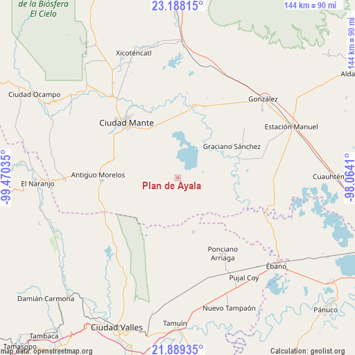
| Upper-left | 23.18815°, | -99.47035° |
| Center: | 22.54028°, | -98.76722° |
| Lower-right: | 21.88935°, | -98.0641° |
| Map W x H: | 144.4×144.4 km | = 89.7×89.7mi |
| max Lat: | 32.7° ⇑13.1% North |
| Plan de Ayala: | 22.54028° |
| min Lat: | ⇓86.9% South 14.53588° |
| min Long | Plan de Ayala | max Long |
| -117.105° | -98.76722° | -86.73105° |
| W 54.1%⇐ | ⇒45.9% E |
Elevation
Elevation of Plan de Ayala is 69 m = 226 ft, and this is 1184.7 m = 3887 ft below average elevation for this country.
| Max E: |
3497 m = 11473 ft | 82.1% |
| Avg. | 1253.7 m = 4113 ft | |
| Plan de Ayala | 69 m = 226 ft | |
Min E: |
-1 m = -3 ft | 17.9% |
See also: Mexico elevation on elevation.city.
Geographical zone
Plan de Ayala is located in North Torrid zone (between Equator and Tropic of Cancer). Distance of this Northern Tropic circle is 99.7 km =62 mi to North.| Distance of | km | miles | from Plan de Ayala |
|---|---|---|---|
| North Pole | 7500.8 | 4660.8 | to North |
| Arctic Circle | 4894.9 | 3041.5 | to North |
| Tropic Cancer | 99.7 | 62 | to North |
| Equator | 2506.2 | 1557.3 | to South |


Nearby cities:
15 places around Plan de Ayala: (largest is in red/bold)
• Celaya
16.9 km =10.5 mi,  276°
276°
• División del Norte
19.5 km =12.1 mi,  213°
213°
• El Abra
27.6 km =17.1 mi,  288°
288°
• El Camotero Dos
10.3 km =6.4 mi,  76°
76°
• Emiliano Zapata
25.1 km =15.6 mi,  322°
322°
• Graciano Sánchez
25.2 km =15.7 mi,  59°
59°
• Los Aztecas
16.3 km =10.1 mi,  105°
105°
• Magdaleno Aguilar
13.9 km =8.6 mi,  152°
152°
• Magiscatzin
30.1 km =18.7 mi,  13°
13°
• Nueva Apolonia
14.8 km =9.2 mi, 108°
• Nuevo Aquismón
24.4 km =15.2 mi,  192°
192°
• Nuevo Tantoán
24 km =14.9 mi,  121°
121°
• Santa Martha
22.8 km =14.2 mi,  164°
164°
• Tantoyuquita
22 km =13.7 mi,  89°
89°
• Triunfo Número Dos
12.2 km =7.6 mi,  266°
266°
Sources, notices
• [Note1] Compared only with cities in Mexico existing in our database
• [Src1] Map data: © OpenStreetMap contributors (CC-BY-SA)
• [Src2] Other city data from geonames.org with taken over terms of usage.
• [Src3] Geographical zone / Annual Mean Temperature by Robert A. Rohde @ Wikipedia
