Rancho Nuevo geodata
Rancho Nuevo (Veracruz) is a populated place; located in Mexico in America/Mexico_City (GMT-6) time zone. With population of 1,164 people, there are 7452 cities with bigger population in this country. Compared to other cities in Mexico, 71.3% of cities are located further ↓South; 72.4% of cities are located further ←West and 93% of cities have higher elevation than Rancho Nuevo. Note1


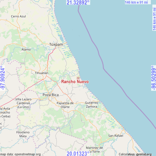
Rancho Nuevo GPS coordinates[2]
20° 40' 21" North, 97° 12' 21.996" West
| Map corner | latitude | longitude |
|---|---|---|
| Upper-left | 21.32892°, | -97.90924° |
| Center: | 20.6725°, | -97.20611° |
| Lower-right: | 20.01323°, | -96.50299° |
| Map W x H: | 146.3×146.3 km | = 90.9×90.9mi |
| max Lat: | 32.7° ⇑28.7% North |
| Rancho Nuevo: | 20.6725° |
| min Lat: | ⇓71.3% South 14.53588° |
| min Long | Rancho Nuevo | max Long |
| -117.105° | -97.20611° | -86.73105° |
| W 72.4%⇐ | ⇒27.6% E |
Elevation
Elevation of Rancho Nuevo is 17 m = 56 ft, and this is 1236.7 m = 4057 ft below average elevation for this country.
| Max E: |
3497 m = 11473 ft | 93% |
| Avg. | 1253.7 m = 4113 ft | |
| Rancho Nuevo | 17 m = 56 ft | |
Min E: |
-1 m = -3 ft | 7% |
See also: Mexico elevation on elevation.city.
Geographical zone
Rancho Nuevo is located in North Torrid zone (between Equator and Tropic of Cancer). Distance of this Northern Tropic circle is 307.4 km =191 mi to North.| Distance of | km | miles | from Rancho Nuevo |
|---|---|---|---|
| North Pole | 7708.5 | 4789.8 | to North |
| Arctic Circle | 5102.6 | 3170.6 | to North |
| Tropic Cancer | 307.4 | 191 | to North |
| Equator | 2298.6 | 1428.3 | to South |


Nearby cities:
15 places around Rancho Nuevo: (largest is in red/bold)
• Barra de Cazones
5.6 km =3.5 mi,  3°
3°
• Barrio Acosta Lagunes
11.5 km =7.1 mi,  282°
282°
• Buenavista
3.1 km =1.9 mi,  353°
353°
• Caristay
10.8 km =6.7 mi,  253°
253°
• Carrizal
10.1 km =6.3 mi,  211°
211°
• Cazones de Herrera
11.4 km =7.1 mi,  288°
288°
• Coyol Norte
7.9 km =4.9 mi, 345°
• Cruz Blanca Número Uno
8.4 km =5.2 mi,  244°
244°
• El Volador
5.5 km =3.4 mi,  233°
233°
• La Encantada
8.8 km =5.5 mi,  317°
317°
• Limón Chiquito
8 km =5 mi, 276°
• Plan de Limón
7.1 km =4.4 mi,  259°
259°
• Poza Verde
12.1 km =7.5 mi,  203°
203°
• Puente de Piedra
7.5 km =4.7 mi,  171°
171°
• Tenixtepec
11.1 km =6.9 mi, 171°
Sources, notices
• [Note1] Compared only with cities in Mexico existing in our database
• [Src1] Map data: © OpenStreetMap contributors (CC-BY-SA)
• [Src2] Other city data from geonames.org with taken over terms of usage.
• [Src3] Geographical zone / Annual Mean Temperature by Robert A. Rohde @ Wikipedia
