La Noria geodata
La Noria (Veracruz) is a populated place; located in Mexico in America/Mexico_City (GMT-6) time zone. With population of 898 people, there are 9712 cities with bigger population in this country. Compared to other cities in Mexico, 63% of cities are located further ↓South; 68.8% of cities are located further ←West and 79.7% of cities have higher elevation than La Noria. Note1


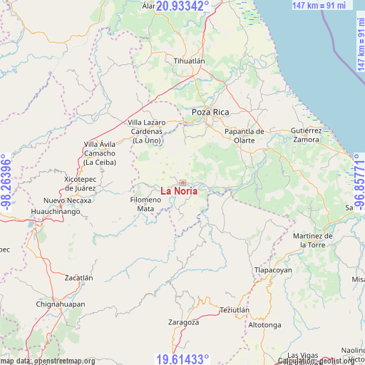
La Noria GPS coordinates[2]
20° 16' 31.008" North, 97° 33' 38.988" West
| Map corner | latitude | longitude |
|---|---|---|
| Upper-left | 20.93342°, | -98.26396° |
| Center: | 20.27528°, | -97.56083° |
| Lower-right: | 19.61433°, | -96.85771° |
| Map W x H: | 146.7×146.7 km | = 91.2×91.2mi |
| max Lat: | 32.7° ⇑37% North |
| La Noria: | 20.27528° |
| min Lat: | ⇓63% South 14.53588° |
| min Long | La Noria | max Long |
| -117.105° | -97.56083° | -86.73105° |
| W 68.8%⇐ | ⇒31.2% E |
Elevation
Elevation of La Noria is 99 m = 325 ft, and this is 1154.7 m = 3788 ft below average elevation for this country.
| Max E: |
3497 m = 11473 ft | 79.7% |
| Avg. | 1253.7 m = 4113 ft | |
| La Noria | 99 m = 325 ft | |
Min E: |
-1 m = -3 ft | 20.3% |
See also: Mexico elevation on elevation.city.
Geographical zone
La Noria is located in North Torrid zone (between Equator and Tropic of Cancer). Distance of this Northern Tropic circle is 351.5 km =218.4 mi to North.| Distance of | km | miles | from La Noria |
|---|---|---|---|
| North Pole | 7752.7 | 4817.3 | to North |
| Arctic Circle | 5146.8 | 3198.1 | to North |
| Tropic Cancer | 351.5 | 218.4 | to North |
| Equator | 2254.4 | 1400.8 | to South |


Nearby cities:
15 places around La Noria: (largest is in red/bold)
• Adolfo Ruiz Cortines
6 km =3.7 mi,  180°
180°
• Buenavista
6.4 km =4 mi,  68°
68°
• El Arenal
3.4 km =2.1 mi,  256°
256°
• El Arenal
5.4 km =3.4 mi,  118°
118°
• El Pacífico
1 km =0.6 mi, 263°
• Entabladero
1 km =0.6 mi,  90°
90°
• José María Morelos
6.9 km =4.3 mi,  165°
165°
• Las Lomas
5.9 km =3.7 mi,  254°
254°
• Lázaro Cárdenas (Santana)
6.5 km =4 mi,  211°
211°
• Ojite de Matamoros
7.4 km =4.6 mi,  110°
110°
• Oriente Meridiano
7.9 km =4.9 mi,  80°
80°
• Sabanas de Xalostoc
6.5 km =4 mi,  155°
155°
• Sabanita
1.3 km =0.8 mi,  150°
150°
• San Leoncio Jamaya
4.7 km =2.9 mi,  332°
332°
• Zacate Limón
6.7 km =4.2 mi, 145°
Sources, notices
• [Note1] Compared only with cities in Mexico existing in our database
• [Src1] Map data: © OpenStreetMap contributors (CC-BY-SA)
• [Src2] Other city data from geonames.org with taken over terms of usage.
• [Src3] Geographical zone / Annual Mean Temperature by Robert A. Rohde @ Wikipedia
