Centro Familiar la Soledad geodata
Centro Familiar la Soledad (Guanajuato) is a populated place; located in Mexico in America/Mexico_City (GMT-6) time zone. With population of 32,159 people, there are 315 cities with bigger population in this country. Compared to other cities in Mexico, 78.4% of cities are located further ↓South; 79.4% of cities are located further →East and 70.5% of cities have lower elevation than Centro Familiar la Soledad. Note1
Current local time in Centro Familiar la Soledad:
06:59 AM, WednesdayDifference from your time zone: hours


Centro Familiar la Soledad GPS coordinates[2]
21° 8' 6" North, 101° 44' 58.992" West
| Map corner | latitude | longitude |
|---|---|---|
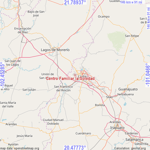
| Upper-left | 21.78937°, | -102.45285° |
| Center: | 21.135°, | -101.74972° |
| Lower-right: | 20.47773°, | -101.0466° |
| Map W x H: | 145.8×145.8 km | = 90.6×90.6mi |
| max Lat: | 32.7° ⇑21.6% North |
| Centro Familiar la Soledad: | 21.135° |
| min Lat: | ⇓78.4% South 14.53588° |
| min Long | Centro Familiar | max Long |
| -117.105° | -101.74972° | -86.73105° |
| W 20.6%⇐ | ⇒79.4% E |
Elevation
Elevation of Centro Familiar la Soledad is 1935 m = 6348 ft, and this is 681.3 m = 2235 ft above average elevation for this country.
| Max E: |
3497 m = 11473 ft | 29.5% |
| Centro Familiar la Soledad | 1935 m 6348 ft | |
| Avg. | 1253.7 m = 4113 ft | |
Min E: |
-1 m = -3 ft | 70.5% |
See also: Mexico elevation on elevation.city.
Geographical zone
Centro Familiar la Soledad is located in North Torrid zone (between Equator and Tropic of Cancer). Distance of this Northern Tropic circle is 255.9 km =159 mi to North.| Distance of | km | miles | from Centro Familiar la Soledad |
|---|---|---|---|
| North Pole | 7657.1 | 4757.9 | to North |
| Arctic Circle | 5051.2 | 3138.7 | to North |
| Tropic Cancer | 255.9 | 159 | to North |
| Equator | 2350 | 1460.2 | to South |


Nearby cities:
15 places around Centro Familiar la Soledad: (largest is in red/bold)
• Barranca de Venaderos
2.3 km =1.4 mi,  156°
156°
• Cañada de Soto
10.7 km =6.6 mi,  220°
220°
• Ejido la Joya
1.4 km =0.9 mi,  49°
49°
• El Ramillete
10.7 km =6.6 mi,  189°
189°
• El Saucillo de Primavera
8.6 km =5.3 mi,  327°
327°
• Fraccionamiento Paseo de las Torres
3.8 km =2.4 mi,  346°
346°
• La Ermita
2.6 km =1.6 mi,  42°
42°
• La Patiña
8.4 km =5.2 mi,  34°
34°
• La Reserva
6.1 km =3.8 mi,  175°
175°
• Lagunillas
7.7 km =4.8 mi, 347°
• León de los Aldama
7.9 km =4.9 mi,  94°
94°
• Malagana (San Antonio del Monte)
9.8 km =6.1 mi, 182°
• Plan de Ayala
7.6 km =4.7 mi, 157°
• Real de la Joya
2.2 km =1.4 mi, 333°
• Rizos de la Joya (Rizos del Saucillo)
2 km =1.2 mi,  320°
320°
Sources, notices
• [Note1] Compared only with cities in Mexico existing in our database
• [Src1] Map data: © OpenStreetMap contributors (CC-BY-SA)
• [Src2] Other city data from geonames.org with taken over terms of usage.
• [Src3] Geographical zone / Annual Mean Temperature by Robert A. Rohde @ Wikipedia
