La Patiña geodata
La Patiña (Guanajuato) is a populated place; located in Mexico in America/Mexico_City (GMT-6) time zone. With population of 788 people, there are 11082 cities with bigger population in this country. Compared to other cities in Mexico, 79.1% of cities are located further ↓South; 79% of cities are located further →East and 66.4% of cities have lower elevation than La Patiña. Note1


La Patiña GPS coordinates[2]
21° 11' 50.46" North, 101° 42' 12.348" West
| Map corner | latitude | longitude |
|---|---|---|
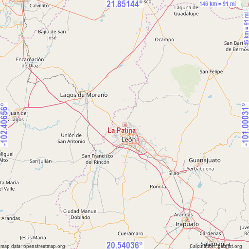
| Upper-left | 21.85144°, | -102.40656° |
| Center: | 21.19735°, | -101.70343° |
| Lower-right: | 20.54036°, | -101.00031° |
| Map W x H: | 145.8×145.8 km | = 90.6×90.6mi |
| max Lat: | 32.7° ⇑20.9% North |
| La Patiña: | 21.19735° |
| min Lat: | ⇓79.1% South 14.53588° |
| min Long | La Patiña | max Long |
| -117.105° | -101.70343° | -86.73105° |
| W 21%⇐ | ⇒79% E |
Elevation
Elevation of La Patiña is 1860 m = 6102 ft, and this is 606.3 m = 1989 ft above average elevation for this country.
| Max E: |
3497 m = 11473 ft | 33.6% |
| La Patiña | 1860 m 6102 ft | |
| Avg. | 1253.7 m = 4113 ft | |
Min E: |
-1 m = -3 ft | 66.4% |
See also: Mexico elevation on elevation.city.
Geographical zone
La Patiña is located in North Torrid zone (between Equator and Tropic of Cancer). Distance of this Northern Tropic circle is 249 km =154.7 mi to North.| Distance of | km | miles | from La Patiña |
|---|---|---|---|
| North Pole | 7650.1 | 4753.6 | to North |
| Arctic Circle | 5044.2 | 3134.3 | to North |
| Tropic Cancer | 249 | 154.7 | to North |
| Equator | 2356.9 | 1464.5 | to South |


Nearby cities:
15 places around La Patiña: (largest is in red/bold)
• Centro Familiar la Soledad
8.4 km =5.2 mi,  214°
214°
• Ejido la Joya
7.1 km =4.4 mi, 211°
• El Penitente
7.1 km =4.4 mi,  105°
105°
• Fraccionamiento Paseo de las Torres
6.5 km =4 mi,  240°
240°
• Hacienda Arriba
4 km =2.5 mi,  359°
359°
• Ibarrilla
6.1 km =3.8 mi,  101°
101°
• La Ermita
5.9 km =3.7 mi, 211°
• La Santa Cruz
8.2 km =5.1 mi, 111°
• Lagunillas
6.5 km =4 mi,  274°
274°
• León de los Aldama
8.2 km =5.1 mi,  157°
157°
• Los Naranjos
8.6 km =5.3 mi, 112°
• Ojo de Agua de los Reyes
8.6 km =5.3 mi, 95°
• Real de la Joya
7.6 km =4.7 mi,  229°
229°
• Rivera del Carmen (Divina Infantita)
6.8 km =4.2 mi, 103°
• Rizos de la Joya (Rizos del Saucillo)
8.1 km =5 mi, 228°
Sources, notices
• [Note1] Compared only with cities in Mexico existing in our database
• [Src1] Map data: © OpenStreetMap contributors (CC-BY-SA)
• [Src2] Other city data from geonames.org with taken over terms of usage.
• [Src3] Geographical zone / Annual Mean Temperature by Robert A. Rohde @ Wikipedia
