La Pastoría geodata
La Pastoría (State of Mexico) is a populated place; located in Mexico in America/Mexico_City (GMT-6) time zone. With population of 5,135 people, there are 1809 cities with bigger population in this country. Compared to other cities in Mexico, 53.2% of cities are located further ↑North; 51.7% of cities are located further ←West and 84.4% of cities have lower elevation than La Pastoría. Note1


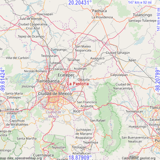
La Pastoría GPS coordinates[2]
19° 32' 35.016" North, 98° 54' 39.996" West
| Map corner | latitude | longitude |
|---|---|---|
| Upper-left | 20.20431°, | -99.61424° |
| Center: | 19.54306°, | -98.91111° |
| Lower-right: | 18.87909°, | -98.20799° |
| Map W x H: | 147.4×147.4 km | = 91.6×91.6mi |
| max Lat: | 32.7° ⇑53.2% North |
| La Pastoría: | 19.54306° |
| min Lat: | ⇓46.8% South 14.53588° |
| min Long | La Pastoría | max Long |
| -117.105° | -98.91111° | -86.73105° |
| W 51.7%⇐ | ⇒48.3% E |
Elevation
Elevation of La Pastoría is 2250 m = 7382 ft, and this is 996.3 m = 3269 ft above average elevation for this country.
| Max E: |
3497 m = 11473 ft | 15.6% |
| La Pastoría | 2250 m 7382 ft | |
| Avg. | 1253.7 m = 4113 ft | |
Min E: |
-1 m = -3 ft | 84.4% |
See also: Mexico elevation on elevation.city.
Geographical zone
La Pastoría is located in North Torrid zone (between Equator and Tropic of Cancer). Distance of this Northern Tropic circle is 432.9 km =269 mi to North.| Distance of | km | miles | from La Pastoría |
|---|---|---|---|
| North Pole | 7834.1 | 4867.9 | to North |
| Arctic Circle | 5228.2 | 3248.7 | to North |
| Tropic Cancer | 432.9 | 269 | to North |
| Equator | 2173 | 1350.2 | to South |


Nearby cities:
15 places around La Pastoría: (largest is in red/bold)
• Ampliación Tezoyuca
4.3 km =2.7 mi,  346°
346°
• Atenguillo
4.3 km =2.7 mi,  57°
57°
• Chiautla
3.1 km =1.9 mi,  77°
77°
• Chiconcuac
2.2 km =1.4 mi,  35°
35°
• Colonia Guadalupe Victoria
5 km =3.1 mi,  189°
189°
• Colonia Lázaro Cárdenas
3.5 km =2.2 mi,  195°
195°
• Ejido San Cristóbal
1.8 km =1.1 mi,  92°
92°
• Francisco I. Madero
2.9 km =1.8 mi,  238°
238°
• San Cristóbal Nexquipayac
4.6 km =2.9 mi,  333°
333°
• San Salvador Atenco
1.2 km =0.7 mi,  320°
320°
• Santiago Chimalpa (Chimalpa)
3.5 km =2.2 mi, 35°
• Texcoco de Mora
4.5 km =2.8 mi,  139°
139°
• Tlaltecahuacán
5.1 km =3.2 mi, 38°
• Tulantongo
4 km =2.5 mi,  108°
108°
• Zapotlán
0.9 km =0.6 mi, 64°
Sources, notices
• [Note1] Compared only with cities in Mexico existing in our database
• [Src1] Map data: © OpenStreetMap contributors (CC-BY-SA)
• [Src2] Other city data from geonames.org with taken over terms of usage.
• [Src3] Geographical zone / Annual Mean Temperature by Robert A. Rohde @ Wikipedia
