Loma Larga geodata
Loma Larga (State of Mexico) is a populated place; located in Mexico in America/Mexico_City (GMT-6) time zone. With population of 3,945 people, there are 2310 cities with bigger population in this country. Compared to other cities in Mexico, 51.4% of cities are located further ↑North; 54.8% of cities are located further →East and 90.3% of cities have lower elevation than Loma Larga. Note1


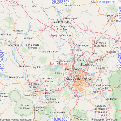
Loma Larga GPS coordinates[2]
19° 37' 39" North, 99° 20' 45.996" West
| Map corner | latitude | longitude |
|---|---|---|
| Upper-left | 20.28839°, | -100.04924° |
| Center: | 19.6275°, | -99.34611° |
| Lower-right: | 18.96388°, | -98.64299° |
| Map W x H: | 147.3×147.3 km | = 91.5×91.5mi |
| max Lat: | 32.7° ⇑51.4% North |
| Loma Larga: | 19.6275° |
| min Lat: | ⇓48.6% South 14.53588° |
| min Long | Loma Larga | max Long |
| -117.105° | -99.34611° | -86.73105° |
| W 45.2%⇐ | ⇒54.8% E |
Elevation
Elevation of Loma Larga is 2418 m = 7933 ft, and this is 1164.3 m = 3820 ft above average elevation for this country.
| Max E: |
3497 m = 11473 ft | 9.7% |
| Loma Larga | 2418 m 7933 ft | |
| Avg. | 1253.7 m = 4113 ft | |
Min E: |
-1 m = -3 ft | 90.3% |
See also: Mexico elevation on elevation.city.
Geographical zone
Loma Larga is located in North Torrid zone (between Equator and Tropic of Cancer). Distance of this Northern Tropic circle is 423.5 km =263.2 mi to North.| Distance of | km | miles | from Loma Larga |
|---|---|---|---|
| North Pole | 7824.7 | 4862 | to North |
| Arctic Circle | 5218.8 | 3242.8 | to North |
| Tropic Cancer | 423.5 | 263.2 | to North |
| Equator | 2182.4 | 1356.1 | to South |


Nearby cities:
15 places around Loma Larga: (largest is in red/bold)
• Caja de Agua
2.6 km =1.6 mi,  311°
311°
• Colonia Llano Grande (Nuevo Ejido)
3.4 km =2.1 mi,  208°
208°
• Colonia Morelos
1.4 km =0.9 mi,  32°
32°
• Colonia San Miguel
5.6 km =3.5 mi, 307°
• Colonia el Mirador
5 km =3.1 mi,  346°
346°
• Ejido los Jarros
4.2 km =2.6 mi,  193°
193°
• Joya del Tejocote
1.6 km =1 mi, 345°
• Loma de Guadalupe (La Biznaga)
3.6 km =2.2 mi,  319°
319°
• Loma de San José
2.5 km =1.6 mi,  49°
49°
• Loma del Río
3 km =1.9 mi, 188°
• Nicolás Romero
4.4 km =2.7 mi,  68°
68°
• Progreso Industrial
1.5 km =0.9 mi, 311°
• San José el Vidrio
4.9 km =3 mi, 305°
• San Miguel Hila
4.4 km =2.7 mi,  149°
149°
• Veintidós de Febrero
1.8 km =1.1 mi,  181°
181°
Sources, notices
• [Note1] Compared only with cities in Mexico existing in our database
• [Src1] Map data: © OpenStreetMap contributors (CC-BY-SA)
• [Src2] Other city data from geonames.org with taken over terms of usage.
• [Src3] Geographical zone / Annual Mean Temperature by Robert A. Rohde @ Wikipedia
