Joya del Tejocote geodata
Joya del Tejocote (State of Mexico) is a populated place; located in Mexico in America/Mexico_City (GMT-6) time zone. With population of 680 people, there are 12778 cities with bigger population in this country. Compared to other cities in Mexico, 51.1% of cities are located further ↑North; 54.9% of cities are located further →East and 93.5% of cities have lower elevation than Joya del Tejocote. Note1


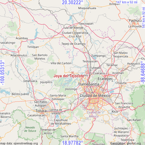
Joya del Tejocote GPS coordinates[2]
19° 38' 29.004" North, 99° 21' 0" West
| Map corner | latitude | longitude |
|---|---|---|
| Upper-left | 20.30222°, | -100.05313° |
| Center: | 19.64139°, | -99.35° |
| Lower-right: | 18.97782°, | -98.64688° |
| Map W x H: | 147.3×147.3 km | = 91.5×91.5mi |
| max Lat: | 32.7° ⇑51.1% North |
| Joya del Tejocote: | 19.64139° |
| min Lat: | ⇓48.9% South 14.53588° |
| min Long | Joya del Tejoco | max Long |
| -117.105° | -99.35° | -86.73105° |
| W 45.1%⇐ | ⇒54.9% E |
Elevation
Elevation of Joya del Tejocote is 2550 m = 8366 ft, and this is 1296.3 m = 4253 ft above average elevation for this country.
| Max E: |
3497 m = 11473 ft | 6.5% |
| Joya del Tejocote | 2550 m 8366 ft | |
| Avg. | 1253.7 m = 4113 ft | |
Min E: |
-1 m = -3 ft | 93.5% |
See also: Mexico elevation on elevation.city.
Geographical zone
Joya del Tejocote is located in North Torrid zone (between Equator and Tropic of Cancer). Distance of this Northern Tropic circle is 422 km =262.2 mi to North.| Distance of | km | miles | from Joya del Tejocote |
|---|---|---|---|
| North Pole | 7823.1 | 4861 | to North |
| Arctic Circle | 5217.3 | 3241.9 | to North |
| Tropic Cancer | 422 | 262.2 | to North |
| Equator | 2183.9 | 1357 | to South |


Nearby cities:
15 places around Joya del Tejocote: (largest is in red/bold)
• Caja de Agua
1.6 km =1 mi,  277°
277°
• Colonia Llano Grande (Nuevo Ejido)
4.6 km =2.9 mi,  195°
195°
• Colonia Morelos
1.2 km =0.7 mi,  109°
109°
• Colonia San Miguel
4.4 km =2.7 mi,  294°
294°
• Colonia el Mirador
3.5 km =2.2 mi,  347°
347°
• El Esclavo
4.5 km =2.8 mi,  330°
330°
• Loma Larga
1.6 km =1 mi,  165°
165°
• Loma de Guadalupe (La Biznaga)
2.3 km =1.4 mi,  301°
301°
• Loma de San José
2.3 km =1.4 mi,  87°
87°
• Loma del Río
4.5 km =2.8 mi,  180°
180°
• Nicolás Romero
4.5 km =2.8 mi, 89°
• Progreso Industrial
0.9 km =0.6 mi,  232°
232°
• San Francisco Magú
4.9 km =3 mi,  2°
2°
• San José el Vidrio
3.8 km =2.4 mi, 290°
• Veintidós de Febrero
3.4 km =2.1 mi, 174°
Sources, notices
• [Note1] Compared only with cities in Mexico existing in our database
• [Src1] Map data: © OpenStreetMap contributors (CC-BY-SA)
• [Src2] Other city data from geonames.org with taken over terms of usage.
• [Src3] Geographical zone / Annual Mean Temperature by Robert A. Rohde @ Wikipedia
