Barrio Santa Cruz geodata
Barrio Santa Cruz (State of Mexico) is a populated place; located in Mexico in America/Mexico_City (GMT-6) time zone. With population of 3,757 people, there are 2441 cities with bigger population in this country. Compared to other cities in Mexico, 57.6% of cities are located further ↑North; 59.7% of cities are located further →East and 95.8% of cities have lower elevation than Barrio Santa Cruz. Note1


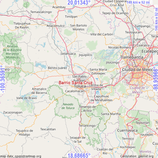
Barrio Santa Cruz GPS coordinates[2]
19° 21' 5.004" North, 99° 39' 46.008" West
| Map corner | latitude | longitude |
|---|---|---|
| Upper-left | 20.01343°, | -100.36591° |
| Center: | 19.35139°, | -99.66278° |
| Lower-right: | 18.68665°, | -98.95966° |
| Map W x H: | 147.5×147.5 km | = 91.7×91.7mi |
| max Lat: | 32.7° ⇑57.6% North |
| Barrio Santa Cruz: | 19.35139° |
| min Lat: | ⇓42.4% South 14.53588° |
| min Long | Barrio Santa Cr | max Long |
| -117.105° | -99.66278° | -86.73105° |
| W 40.3%⇐ | ⇒59.7% E |
Elevation
Elevation of Barrio Santa Cruz is 2618 m = 8589 ft, and this is 1364.3 m = 4476 ft above average elevation for this country.
| Max E: |
3497 m = 11473 ft | 4.2% |
| Barrio Santa Cruz | 2618 m 8589 ft | |
| Avg. | 1253.7 m = 4113 ft | |
Min E: |
-1 m = -3 ft | 95.8% |
See also: Mexico elevation on elevation.city.
Geographical zone
Barrio Santa Cruz is located in North Torrid zone (between Equator and Tropic of Cancer). Distance of this Northern Tropic circle is 454.2 km =282.2 mi to North.| Distance of | km | miles | from Barrio Santa Cruz |
|---|---|---|---|
| North Pole | 7855.4 | 4881.1 | to North |
| Arctic Circle | 5249.5 | 3261.9 | to North |
| Tropic Cancer | 454.2 | 282.2 | to North |
| Equator | 2151.7 | 1337 | to South |


Nearby cities:
15 places around Barrio Santa Cruz: (largest is in red/bold)
• Barrio Bordo Nuevo
3.3 km =2.1 mi,  340°
340°
• Barrio de Jesús Fracción Primera
3.1 km =1.9 mi,  305°
305°
• Barrio del Cajón
4.5 km =2.8 mi,  6°
6°
• Calixtlahuaca
3.2 km =2 mi,  239°
239°
• Colonia Aviación Autopan
4.4 km =2.7 mi, 314°
• Fraccionamiento Real de San Pablo
4.5 km =2.8 mi,  19°
19°
• Jicaltepec Autopan
3.2 km =2 mi,  45°
45°
• Jicaltepec Cuexcontitlán
4.4 km =2.7 mi,  56°
56°
• La Loma Cuexcontitlán
3.5 km =2.2 mi, 24°
• La Planada (El Arenal)
2.5 km =1.6 mi,  216°
216°
• Ojo de Agua Autopan
3.2 km =2 mi,  289°
289°
• Palmillas
2.2 km =1.4 mi,  257°
257°
• San Andrés Cuexcontitlán
4.4 km =2.7 mi,  79°
79°
• San Marcos Yachihuacaltepec
3.6 km =2.2 mi,  208°
208°
• San Pablo Autopan
0.8 km =0.5 mi, 46°
Sources, notices
• [Note1] Compared only with cities in Mexico existing in our database
• [Src1] Map data: © OpenStreetMap contributors (CC-BY-SA)
• [Src2] Other city data from geonames.org with taken over terms of usage.
• [Src3] Geographical zone / Annual Mean Temperature by Robert A. Rohde @ Wikipedia
