San Andrés Cuexcontitlán geodata
San Andrés Cuexcontitlán (Morelos) is a populated place; located in Mexico in America/Mexico_City (GMT-6) time zone. With population of 18,005 people, there are 541 cities with bigger population in this country. Compared to other cities in Mexico, 57.3% of cities are located further ↑North; 58.9% of cities are located further →East and 94.9% of cities have lower elevation than San Andrés Cuexcontitlán. Note1
Current local time in San Andrés Cuexcontitlán:
07:22 AM, MondayDifference from your time zone: hours


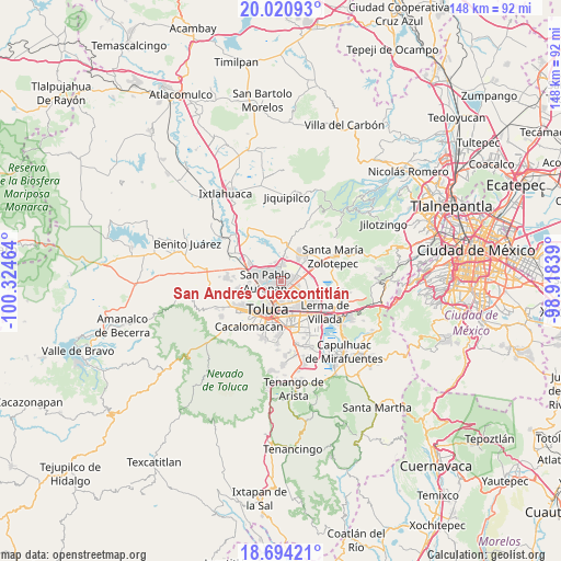
San Andrés Cuexcontitlán GPS coordinates[2]
19° 21' 32.112" North, 99° 37' 17.436" West
| Map corner | latitude | longitude |
|---|---|---|
| Upper-left | 20.02093°, | -100.32464° |
| Center: | 19.35892°, | -99.62151° |
| Lower-right: | 18.69421°, | -98.91839° |
| Map W x H: | 147.5×147.5 km | = 91.7×91.7mi |
| max Lat: | 32.7° ⇑57.3% North |
| San Andrés Cuexcontitlán: | 19.35892° |
| min Lat: | ⇓42.7% South 14.53588° |
| min Long | San Andrés Cue | max Long |
| -117.105° | -99.62151° | -86.73105° |
| W 41.1%⇐ | ⇒58.9% E |
Elevation
Elevation of San Andrés Cuexcontitlán is 2593 m = 8507 ft, and this is 1339.3 m = 4394 ft above average elevation for this country.
| Max E: |
3497 m = 11473 ft | 5.1% |
| San Andrés Cuexcontitlán | 2593 m 8507 ft | |
| Avg. | 1253.7 m = 4113 ft | |
Min E: |
-1 m = -3 ft | 94.9% |
See also: Mexico elevation on elevation.city.
Geographical zone
San Andrés Cuexcontitlán is located in North Torrid zone (between Equator and Tropic of Cancer). Distance of this Northern Tropic circle is 453.4 km =281.7 mi to North.| Distance of | km | miles | from San Andrés Cuexcontitlán |
|---|---|---|---|
| North Pole | 7854.6 | 4880.6 | to North |
| Arctic Circle | 5248.7 | 3261.4 | to North |
| Tropic Cancer | 453.4 | 281.7 | to North |
| Equator | 2152.5 | 1337.5 | to South |


Nearby cities:
15 places around San Andrés Cuexcontitlán: (largest is in red/bold)
• Barrio Santa Cruz
4.4 km =2.7 mi,  259°
259°
• Barrio del Cajón
5.3 km =3.3 mi,  313°
313°
• Fraccionamiento Real de San Pablo
4.4 km =2.7 mi,  320°
320°
• Galaxias Toluca
5.3 km =3.3 mi,  325°
325°
• Jicaltepec Autopan
2.5 km =1.6 mi,  304°
304°
• Jicaltepec Cuexcontitlán
1.7 km =1.1 mi,  338°
338°
• La Loma Cuexcontitlán
3.7 km =2.3 mi, 309°
• La Y
5.5 km =3.4 mi,  37°
37°
• Llano de la Y
4.9 km =3 mi,  6°
6°
• San Diego Linares
3.5 km =2.2 mi, 331°
• San Diego los Padres Cuexcontitlán Sección 5 B
2.1 km =1.3 mi,  27°
27°
• San José Guadalupe Otzacatipan
3.5 km =2.2 mi,  116°
116°
• San Mateo Otzacatipan
3.5 km =2.2 mi,  146°
146°
• San Nicolás Tolentino
5.2 km =3.2 mi,  90°
90°
• San Pablo Autopan
3.8 km =2.4 mi,  265°
265°
Sources, notices
• [Note1] Compared only with cities in Mexico existing in our database
• [Src1] Map data: © OpenStreetMap contributors (CC-BY-SA)
• [Src2] Other city data from geonames.org with taken over terms of usage.
• [Src3] Geographical zone / Annual Mean Temperature by Robert A. Rohde @ Wikipedia
