San Miguel Jaltocan geodata
San Miguel Jaltocan (State of Mexico) is a populated place; located in Mexico in America/Mexico_City (GMT-6) time zone. With population of 3,681 people, there are 2493 cities with bigger population in this country. Compared to other cities in Mexico, 51% of cities are located further ↓South; 50.5% of cities are located further →East and 84.4% of cities have lower elevation than San Miguel Jaltocan. Note1


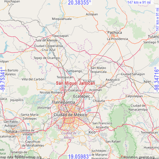
San Miguel Jaltocan GPS coordinates[2]
19° 43' 23.016" North, 99° 3' 1.008" West
| Map corner | latitude | longitude |
|---|---|---|
| Upper-left | 20.38355°, | -99.75341° |
| Center: | 19.72306°, | -99.05028° |
| Lower-right: | 19.05983°, | -98.34716° |
| Map W x H: | 147.2×147.2 km | = 91.5×91.5mi |
| max Lat: | 32.7° ⇑49% North |
| San Miguel Jaltocan: | 19.72306° |
| min Lat: | ⇓51% South 14.53588° |
| min Long | San Miguel Jalt | max Long |
| -117.105° | -99.05028° | -86.73105° |
| W 49.5%⇐ | ⇒50.5% E |
Elevation
Elevation of San Miguel Jaltocan is 2250 m = 7382 ft, and this is 996.3 m = 3269 ft above average elevation for this country.
| Max E: |
3497 m = 11473 ft | 15.6% |
| San Miguel Jaltocan | 2250 m 7382 ft | |
| Avg. | 1253.7 m = 4113 ft | |
Min E: |
-1 m = -3 ft | 84.4% |
See also: Mexico elevation on elevation.city.
Geographical zone
San Miguel Jaltocan is located in North Torrid zone (between Equator and Tropic of Cancer). Distance of this Northern Tropic circle is 412.9 km =256.6 mi to North.| Distance of | km | miles | from San Miguel Jaltocan |
|---|---|---|---|
| North Pole | 7814.1 | 4855.5 | to North |
| Arctic Circle | 5208.2 | 3236.2 | to North |
| Tropic Cancer | 412.9 | 256.6 | to North |
| Equator | 2193 | 1362.7 | to South |


Nearby cities:
15 places around San Miguel Jaltocan: (largest is in red/bold)
• Colonia Pozos y Vías (Fracción Diecisiete A)
3.5 km =2.2 mi,  231°
231°
• Colonia la Asunción
3.9 km =2.4 mi,  202°
202°
• Colonia los Aguiluchos
4.2 km =2.6 mi,  274°
274°
• El Progreso (Villa Esmeralda)
5.3 km =3.3 mi,  221°
221°
• Ex-Hacienda Santa Inés
3 km =1.9 mi, 231°
• Jaltenco
5.6 km =3.5 mi,  306°
306°
• Ojo de Agua
6.4 km =4 mi,  138°
138°
• Prados San Francisco
3.5 km =2.2 mi, 267°
• Pueblo Nuevo de Morelos
4.4 km =2.7 mi,  355°
355°
• San Antonio Xahuento
6.9 km =4.3 mi,  239°
239°
• San Juan Pueblo Nuevo
6.7 km =4.2 mi,  28°
28°
• San Sebastián
6.8 km =4.2 mi, 355°
• Santa Ana Nextlalpan
3.3 km =2.1 mi, 308°
• Tonanitla
3.9 km =2.4 mi,  184°
184°
• Unidad Familiar Confederación de Trabajadores Campesinos
6.7 km =4.2 mi,  333°
333°
Sources, notices
• [Note1] Compared only with cities in Mexico existing in our database
• [Src1] Map data: © OpenStreetMap contributors (CC-BY-SA)
• [Src2] Other city data from geonames.org with taken over terms of usage.
• [Src3] Geographical zone / Annual Mean Temperature by Robert A. Rohde @ Wikipedia
