San Antonio Xahuento geodata
San Antonio Xahuento (State of Mexico) is a populated place; located in Mexico in America/Mexico_City (GMT-6) time zone. With population of 1,235 people, there are 7029 cities with bigger population in this country. Compared to other cities in Mexico, 50.2% of cities are located further ↓South; 51.3% of cities are located further →East and 84.3% of cities have lower elevation than San Antonio Xahuento. Note1


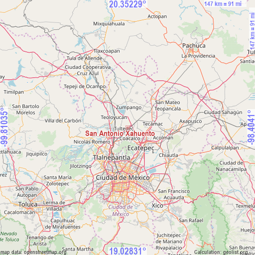
San Antonio Xahuento GPS coordinates[2]
19° 41' 30.012" North, 99° 6' 25.992" West
| Map corner | latitude | longitude |
|---|---|---|
| Upper-left | 20.35229°, | -99.81035° |
| Center: | 19.69167°, | -99.10722° |
| Lower-right: | 19.02831°, | -98.4041° |
| Map W x H: | 147.2×147.2 km | = 91.5×91.5mi |
| max Lat: | 32.7° ⇑49.8% North |
| San Antonio Xahuento: | 19.69167° |
| min Lat: | ⇓50.2% South 14.53588° |
| min Long | San Antonio Xah | max Long |
| -117.105° | -99.10722° | -86.73105° |
| W 48.7%⇐ | ⇒51.3% E |
Elevation
Elevation of San Antonio Xahuento is 2247 m = 7372 ft, and this is 993.3 m = 3259 ft above average elevation for this country.
| Max E: |
3497 m = 11473 ft | 15.7% |
| San Antonio Xahuento | 2247 m 7372 ft | |
| Avg. | 1253.7 m = 4113 ft | |
Min E: |
-1 m = -3 ft | 84.3% |
See also: Mexico elevation on elevation.city.
Geographical zone
San Antonio Xahuento is located in North Torrid zone (between Equator and Tropic of Cancer). Distance of this Northern Tropic circle is 416.4 km =258.7 mi to North.| Distance of | km | miles | from San Antonio Xahuento |
|---|---|---|---|
| North Pole | 7817.6 | 4857.6 | to North |
| Arctic Circle | 5211.7 | 3238.4 | to North |
| Tropic Cancer | 416.4 | 258.7 | to North |
| Equator | 2189.5 | 1360.5 | to South |


Nearby cities:
15 places around San Antonio Xahuento: (largest is in red/bold)
• Colonia 2 de Septiembre
1.4 km =0.9 mi,  314°
314°
• Colonia Pozos y Vías (Fracción Diecisiete A)
3.5 km =2.2 mi,  67°
67°
• Colonia la Asunción
4.5 km =2.8 mi,  91°
91°
• Colonia los Aguiluchos
4.2 km =2.6 mi,  24°
24°
• Ejido San Pablito (Paraje San Pablito)
2.7 km =1.7 mi,  205°
205°
• El Progreso (Villa Esmeralda)
2.5 km =1.6 mi,  102°
102°
• Ex-Hacienda Santa Inés
4 km =2.5 mi, 65°
• Lomas de Tenopalco
1.3 km =0.8 mi,  335°
335°
• Melchor Ocampo
4.1 km =2.5 mi,  286°
286°
• Paraje Trigo Tenco
2.2 km =1.4 mi, 214°
• Prados San Francisco
4.1 km =2.5 mi,  36°
36°
• San Francisco Tenopalco
2.5 km =1.6 mi, 338°
• San Pablo de las Salinas
3.1 km =1.9 mi,  154°
154°
• Santiago Teyahualco
4 km =2.5 mi, 207°
• Tultepec
2.3 km =1.4 mi,  251°
251°
Sources, notices
• [Note1] Compared only with cities in Mexico existing in our database
• [Src1] Map data: © OpenStreetMap contributors (CC-BY-SA)
• [Src2] Other city data from geonames.org with taken over terms of usage.
• [Src3] Geographical zone / Annual Mean Temperature by Robert A. Rohde @ Wikipedia
