Ocopulco geodata
Ocopulco (State of Mexico) is a populated place; located in Mexico in America/Mexico_City (GMT-6) time zone. With population of 3,317 people, there are 2744 cities with bigger population in this country. Compared to other cities in Mexico, 52.1% of cities are located further ↑North; 52% of cities are located further ←West and 85.1% of cities have lower elevation than Ocopulco. Note1


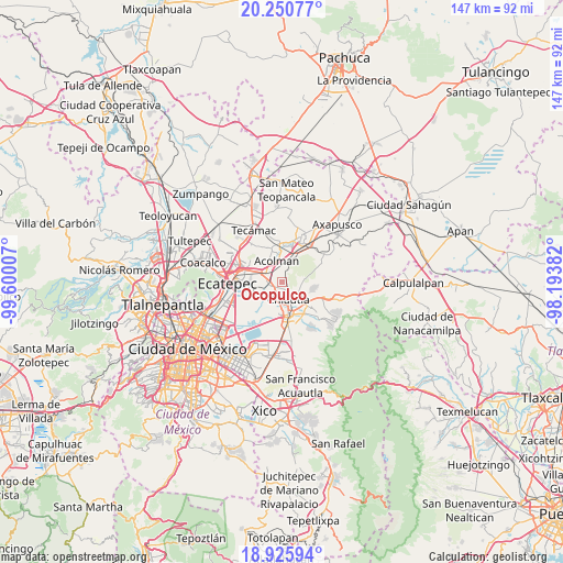
Ocopulco GPS coordinates[2]
19° 35' 22.992" North, 98° 53' 48.984" West
| Map corner | latitude | longitude |
|---|---|---|
| Upper-left | 20.25077°, | -99.60007° |
| Center: | 19.58972°, | -98.89694° |
| Lower-right: | 18.92594°, | -98.19382° |
| Map W x H: | 147.3×147.3 km | = 91.5×91.5mi |
| max Lat: | 32.7° ⇑52.1% North |
| Ocopulco: | 19.58972° |
| min Lat: | ⇓47.9% South 14.53588° |
| min Long | Ocopulco | max Long |
| -117.105° | -98.89694° | -86.73105° |
| W 52%⇐ | ⇒48% E |
Elevation
Elevation of Ocopulco is 2261 m = 7418 ft, and this is 1007.3 m = 3305 ft above average elevation for this country.
| Max E: |
3497 m = 11473 ft | 14.9% |
| Ocopulco | 2261 m 7418 ft | |
| Avg. | 1253.7 m = 4113 ft | |
Min E: |
-1 m = -3 ft | 85.1% |
See also: Mexico elevation on elevation.city.
Geographical zone
Ocopulco is located in North Torrid zone (between Equator and Tropic of Cancer). Distance of this Northern Tropic circle is 427.7 km =265.8 mi to North.| Distance of | km | miles | from Ocopulco |
|---|---|---|---|
| North Pole | 7828.9 | 4864.7 | to North |
| Arctic Circle | 5223 | 3245.4 | to North |
| Tropic Cancer | 427.7 | 265.8 | to North |
| Equator | 2178.2 | 1353.5 | to South |


Nearby cities:
15 places around Ocopulco: (largest is in red/bold)
• Ampliación Tezoyuca
2.7 km =1.7 mi,  247°
247°
• Atenguillo
3.6 km =2.2 mi,  143°
143°
• Chiautla
4.8 km =3 mi,  161°
161°
• Chiconcuac
3.4 km =2.1 mi,  183°
183°
• La Concepción
1.4 km =0.9 mi,  346°
346°
• San Cristóbal Nexquipayac
3.7 km =2.3 mi, 253°
• San Lucas Huitzilhuacán
1.4 km =0.9 mi,  102°
102°
• San Pedro Tepetitlán
4.4 km =2.7 mi,  11°
11°
• San Salvador Atenco
4.8 km =3 mi,  208°
208°
• Santiago Chimalpa (Chimalpa)
2.4 km =1.5 mi,  166°
166°
• Tepetitlán
3.4 km =2.1 mi,  124°
124°
• Tequisistlán
4.7 km =2.9 mi,  279°
279°
• Tezoyuca
1.5 km =0.9 mi, 283°
• Tlaltecahuacán
2.1 km =1.3 mi,  125°
125°
• Zapotlán
4.8 km =3 mi,  187°
187°
Sources, notices
• [Note1] Compared only with cities in Mexico existing in our database
• [Src1] Map data: © OpenStreetMap contributors (CC-BY-SA)
• [Src2] Other city data from geonames.org with taken over terms of usage.
• [Src3] Geographical zone / Annual Mean Temperature by Robert A. Rohde @ Wikipedia
