Paseo Puente Viejo geodata
Paseo Puente Viejo (Jalisco) is a populated place; located in Mexico in America/Mexico_City (GMT-6) time zone. With population of 2,668 people, there are 3314 cities with bigger population in this country. Compared to other cities in Mexico, 69.3% of cities are located further ↓South; 86.5% of cities are located further →East and 53.6% of cities have lower elevation than Paseo Puente Viejo. Note1


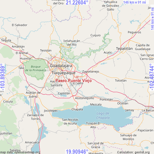
Paseo Puente Viejo GPS coordinates[2]
20° 34' 9.012" North, 103° 11' 26.016" West
| Map corner | latitude | longitude |
|---|---|---|
| Upper-left | 21.22604°, | -103.89369° |
| Center: | 20.56917°, | -103.19056° |
| Lower-right: | 19.90946°, | -102.48744° |
| Map W x H: | 146.4×146.4 km | = 91×91mi |
| max Lat: | 32.7° ⇑30.7% North |
| Paseo Puente Viejo: | 20.56917° |
| min Lat: | ⇓69.3% South 14.53588° |
| min Long | Paseo Puente Vi | max Long |
| -117.105° | -103.19056° | -86.73105° |
| W 13.5%⇐ | ⇒86.5% E |
Elevation
Elevation of Paseo Puente Viejo is 1552 m = 5092 ft, and this is 298.3 m = 979 ft above average elevation for this country.
| Max E: |
3497 m = 11473 ft | 46.4% |
| Paseo Puente Viejo | 1552 m 5092 ft | |
| Avg. | 1253.7 m = 4113 ft | |
Min E: |
-1 m = -3 ft | 53.6% |
See also: Mexico elevation on elevation.city.
Geographical zone
Paseo Puente Viejo is located in North Torrid zone (between Equator and Tropic of Cancer). Distance of this Northern Tropic circle is 318.8 km =198.1 mi to North.| Distance of | km | miles | from Paseo Puente Viejo |
|---|---|---|---|
| North Pole | 7720 | 4797 | to North |
| Arctic Circle | 5114.1 | 3177.8 | to North |
| Tropic Cancer | 318.8 | 198.1 | to North |
| Equator | 2287.1 | 1421.1 | to South |


Nearby cities:
15 places around Paseo Puente Viejo: (largest is in red/bold)
• Centro de Readaptación Social
1.7 km =1.1 mi,  190°
190°
• Colonia Guadalupana
3 km =1.9 mi,  264°
264°
• El Salto
5.7 km =3.5 mi,  170°
170°
• El Vado
5.7 km =3.5 mi,  38°
38°
• Galaxia Bonito Jalisco
7.3 km =4.5 mi, 191°
• Hacienda Vieja del Castillo (Castillo Viejo)
6.5 km =4 mi,  239°
239°
• Juanacatlán
7 km =4.3 mi,  162°
162°
• La Laja
7.3 km =4.5 mi,  80°
80°
• La Punta
2.2 km =1.4 mi,  276°
276°
• Los Amiales
6.5 km =4 mi,  320°
320°
• Mismaloya (Fraccionamiento Pedregal de Santa Martha)
4.6 km =2.9 mi,  25°
25°
• Paseo de las Cañadas
5.9 km =3.7 mi,  352°
352°
• Pueblos de la Barranca (El Maestranzo)
5.9 km =3.7 mi,  72°
72°
• Puente Grande
3.8 km =2.4 mi,  89°
89°
• Tonalá
7.6 km =4.7 mi, 323°
Sources, notices
• [Note1] Compared only with cities in Mexico existing in our database
• [Src1] Map data: © OpenStreetMap contributors (CC-BY-SA)
• [Src2] Other city data from geonames.org with taken over terms of usage.
• [Src3] Geographical zone / Annual Mean Temperature by Robert A. Rohde @ Wikipedia
