Paseo de las Cañadas geodata
Paseo de las Cañadas (Jalisco) is a populated place; located in Mexico in America/Mexico_City (GMT-6) time zone. With population of 1,963 people, there are 4443 cities with bigger population in this country. Compared to other cities in Mexico, 70.4% of cities are located further ↓South; 86.6% of cities are located further →East and 53.8% of cities have lower elevation than Paseo de las Cañadas. Note1


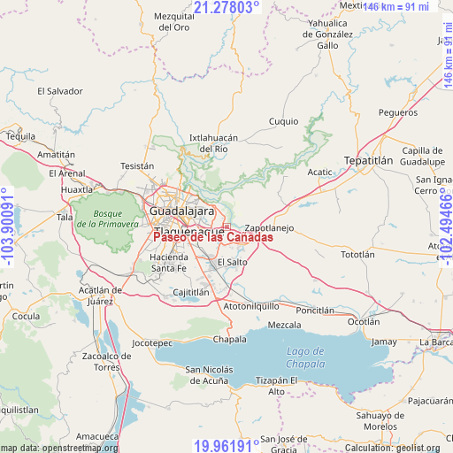
Paseo de las Cañadas GPS coordinates[2]
20° 37' 17.004" North, 103° 11' 52.008" West
| Map corner | latitude | longitude |
|---|---|---|
| Upper-left | 21.27803°, | -103.90091° |
| Center: | 20.62139°, | -103.19778° |
| Lower-right: | 19.96191°, | -102.49466° |
| Map W x H: | 146.3×146.3 km | = 90.9×90.9mi |
| max Lat: | 32.7° ⇑29.6% North |
| Paseo de las Cañadas: | 20.62139° |
| min Lat: | ⇓70.4% South 14.53588° |
| min Long | Paseo de las Ca | max Long |
| -117.105° | -103.19778° | -86.73105° |
| W 13.4%⇐ | ⇒86.6% E |
Elevation
Elevation of Paseo de las Cañadas is 1558 m = 5112 ft, and this is 304.3 m = 998 ft above average elevation for this country.
| Max E: |
3497 m = 11473 ft | 46.2% |
| Paseo de las Cañadas | 1558 m 5112 ft | |
| Avg. | 1253.7 m = 4113 ft | |
Min E: |
-1 m = -3 ft | 53.8% |
See also: Mexico elevation on elevation.city.
Geographical zone
Paseo de las Cañadas is located in North Torrid zone (between Equator and Tropic of Cancer). Distance of this Northern Tropic circle is 313 km =194.5 mi to North.| Distance of | km | miles | from Paseo de las Cañadas |
|---|---|---|---|
| North Pole | 7714.2 | 4793.4 | to North |
| Arctic Circle | 5108.3 | 3174.1 | to North |
| Tropic Cancer | 313 | 194.5 | to North |
| Equator | 2292.9 | 1424.7 | to South |


Nearby cities:
15 places around Paseo de las Cañadas: (largest is in red/bold)
• Centro de Readaptación Social
7.5 km =4.7 mi,  176°
176°
• Colonia Guadalupana
6.5 km =4 mi,  199°
199°
• Coyula
5.1 km =3.2 mi,  324°
324°
• El Mirador
9.3 km =5.8 mi,  237°
237°
• El Vado
4.5 km =2.8 mi,  107°
107°
• La Laja
9.1 km =5.7 mi,  120°
120°
• La Loma
9.9 km =6.2 mi, 118°
• La Punta
5.7 km =3.5 mi,  194°
194°
• Los Amiales
3.5 km =2.2 mi,  256°
256°
• Mismaloya (Fraccionamiento Pedregal de Santa Martha)
3.2 km =2 mi, 120°
• Paseo Puente Viejo
5.9 km =3.7 mi,  172°
172°
• Pueblos de la Barranca (El Maestranzo)
7.5 km =4.7 mi, 122°
• Puente Grande
7.3 km =4.5 mi,  141°
141°
• Residencias el Prado (Jardines del Prado)
7.4 km =4.6 mi,  342°
342°
• Tonalá
3.8 km =2.4 mi,  275°
275°
Sources, notices
• [Note1] Compared only with cities in Mexico existing in our database
• [Src1] Map data: © OpenStreetMap contributors (CC-BY-SA)
• [Src2] Other city data from geonames.org with taken over terms of usage.
• [Src3] Geographical zone / Annual Mean Temperature by Robert A. Rohde @ Wikipedia
