Pantitlán geodata
Pantitlán (Guerrero) is a populated place; located in Mexico in America/Mexico_City (GMT-6) time zone. With population of 2,413 people, there are 3654 cities with bigger population in this country. Compared to other cities in Mexico, 81.9% of cities are located further ↑North; 51.3% of cities are located further →East and 65% of cities have lower elevation than Pantitlán. Note1


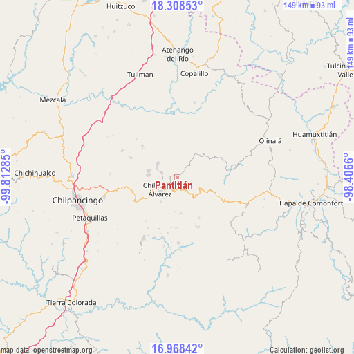
Pantitlán GPS coordinates[2]
17° 38' 22.992" North, 99° 6' 34.992" West
| Map corner | latitude | longitude |
|---|---|---|
| Upper-left | 18.30853°, | -99.81285° |
| Center: | 17.63972°, | -99.10972° |
| Lower-right: | 16.96842°, | -98.4066° |
| Map W x H: | 149×149 km | = 92.6×92.6mi |
| max Lat: | 32.7° ⇑81.9% North |
| Pantitlán: | 17.63972° |
| min Lat: | ⇓18.1% South 14.53588° |
| min Long | Pantitlán | max Long |
| -117.105° | -99.10972° | -86.73105° |
| W 48.7%⇐ | ⇒51.3% E |
Elevation
Elevation of Pantitlán is 1830 m = 6004 ft, and this is 576.3 m = 1891 ft above average elevation for this country.
| Max E: |
3497 m = 11473 ft | 35% |
| Pantitlán | 1830 m 6004 ft | |
| Avg. | 1253.7 m = 4113 ft | |
Min E: |
-1 m = -3 ft | 65% |
See also: Mexico elevation on elevation.city.
Geographical zone
Pantitlán is located in North Torrid zone (between Equator and Tropic of Cancer). Distance of this Northern Tropic circle is 644.6 km =400.5 mi to North.| Distance of | km | miles | from Pantitlán |
|---|---|---|---|
| North Pole | 8045.7 | 4999.4 | to North |
| Arctic Circle | 5439.8 | 3380.1 | to North |
| Tropic Cancer | 644.6 | 400.5 | to North |
| Equator | 1961.4 | 1218.8 | to South |


Nearby cities:
15 places around Pantitlán: (largest is in red/bold)
• Acatlán
6.6 km =4.1 mi,  287°
287°
• Agua Zarca
6.2 km =3.9 mi,  216°
216°
• Ayahualco
8.3 km =5.2 mi,  257°
257°
• Chilapa de Álvarez
8.2 km =5.1 mi,  236°
236°
• La Mohonera
9.8 km =6.1 mi,  269°
269°
• Los Magueyes
6.7 km =4.2 mi, 258°
• Nejapa
4.7 km =2.9 mi,  232°
232°
• Oztotitlán
9.7 km =6 mi,  68°
68°
• Santa Cruz
1.4 km =0.9 mi,  319°
319°
• Tecoanapa
8.1 km =5 mi,  61°
61°
• Tepetlacingo
9.4 km =5.8 mi,  204°
204°
• Trigomila
6.7 km =4.2 mi, 198°
• Yetlancingo
9.1 km =5.7 mi,  356°
356°
• Zitlala
9.9 km =6.2 mi,  304°
304°
• Zompeltepec
10.1 km =6.3 mi,  150°
150°
Sources, notices
• [Note1] Compared only with cities in Mexico existing in our database
• [Src1] Map data: © OpenStreetMap contributors (CC-BY-SA)
• [Src2] Other city data from geonames.org with taken over terms of usage.
• [Src3] Geographical zone / Annual Mean Temperature by Robert A. Rohde @ Wikipedia
