San Juan Ahuehueyo geodata
San Juan Ahuehueyo (Morelos) is a populated place; located in Mexico in America/Mexico_City (GMT-6) time zone. With population of 2,325 people, there are 3796 cities with bigger population in this country. Compared to other cities in Mexico, 70.1% of cities are located further ↑North; 51.4% of cities are located further ←West and 55.7% of cities have higher elevation than San Juan Ahuehueyo. Note1


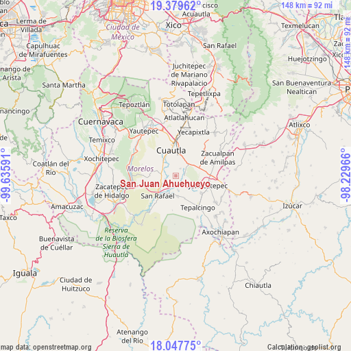
San Juan Ahuehueyo GPS coordinates[2]
18° 42' 54" North, 98° 55' 58.008" West
| Map corner | latitude | longitude |
|---|---|---|
| Upper-left | 19.37962°, | -99.63591° |
| Center: | 18.715°, | -98.93278° |
| Lower-right: | 18.04775°, | -98.22966° |
| Map W x H: | 148.1×148.1 km | = 92×92mi |
| max Lat: | 32.7° ⇑70.1% North |
| San Juan Ahuehueyo: | 18.715° |
| min Lat: | ⇓29.9% South 14.53588° |
| min Long | San Juan Ahuehu | max Long |
| -117.105° | -98.93278° | -86.73105° |
| W 51.4%⇐ | ⇒48.6% E |
Elevation
Elevation of San Juan Ahuehueyo is 1170 m = 3839 ft, and this is 83.7 m = 275 ft below average elevation for this country.
| Max E: |
3497 m = 11473 ft | 55.7% |
| Avg. | 1253.7 m = 4113 ft | |
| San Juan Ahuehueyo | 1170 m = 3839 ft | |
Min E: |
-1 m = -3 ft | 44.3% |
See also: Mexico elevation on elevation.city.
Geographical zone
San Juan Ahuehueyo is located in North Torrid zone (between Equator and Tropic of Cancer). Distance of this Northern Tropic circle is 525 km =326.2 mi to North.| Distance of | km | miles | from San Juan Ahuehueyo |
|---|---|---|---|
| North Pole | 7926.1 | 4925 | to North |
| Arctic Circle | 5320.3 | 3305.9 | to North |
| Tropic Cancer | 525 | 326.2 | to North |
| Equator | 2080.9 | 1293 | to South |


Nearby cities:
15 places around San Juan Ahuehueyo: (largest is in red/bold)
• Abelardo L. Rodríguez
6.1 km =3.8 mi,  294°
294°
• Colonia Ejidal Rafael Merino
6.3 km =3.9 mi,  299°
299°
• Constancio Farfán (La Pascuala)
3.7 km =2.3 mi,  323°
323°
• El Salitre
5.1 km =3.2 mi,  211°
211°
• Fraccionamiento Huertas de Cuautla
5.9 km =3.7 mi,  21°
21°
• Huitzililla
4.4 km =2.7 mi,  121°
121°
• Moyotepec
6.6 km =4.1 mi,  275°
275°
• Niños Héroes
6.1 km =3.8 mi,  336°
336°
• Olintepec
6.4 km =4 mi, 296°
• Reforma
7.5 km =4.7 mi,  358°
358°
• San Vicente de Juárez
6.5 km =4 mi,  237°
237°
• Tenextepango
3.1 km =1.9 mi, 300°
• Unidad Habitacional 10 de Abril
4.7 km =2.9 mi, 21°
• Valle de Morelos
4.3 km =2.7 mi, 299°
• Xalostoc
3.7 km =2.3 mi,  76°
76°
Sources, notices
• [Note1] Compared only with cities in Mexico existing in our database
• [Src1] Map data: © OpenStreetMap contributors (CC-BY-SA)
• [Src2] Other city data from geonames.org with taken over terms of usage.
• [Src3] Geographical zone / Annual Mean Temperature by Robert A. Rohde @ Wikipedia
