Huitzililla geodata
Huitzililla (Morelos) is a populated place; located in Mexico in America/Mexico_City (GMT-6) time zone. With population of 2,535 people, there are 3499 cities with bigger population in this country. Compared to other cities in Mexico, 70.3% of cities are located further ↑North; 52% of cities are located further ←West and 54.5% of cities have higher elevation than Huitzililla. Note1


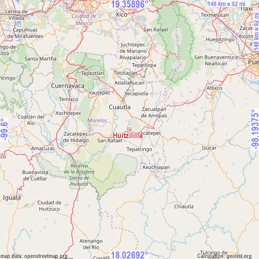
Huitzililla GPS coordinates[2]
18° 41' 39.3" North, 98° 53' 48.732" West
| Map corner | latitude | longitude |
|---|---|---|
| Upper-left | 19.35896°, | -99.6° |
| Center: | 18.69425°, | -98.89687° |
| Lower-right: | 18.02692°, | -98.19375° |
| Map W x H: | 148.1×148.1 km | = 92×92mi |
| max Lat: | 32.7° ⇑70.3% North |
| Huitzililla: | 18.69425° |
| min Lat: | ⇓29.7% South 14.53588° |
| min Long | Huitzililla | max Long |
| -117.105° | -98.89687° | -86.73105° |
| W 52%⇐ | ⇒48% E |
Elevation
Elevation of Huitzililla is 1218 m = 3996 ft, and this is 35.7 m = 117 ft below average elevation for this country.
| Max E: |
3497 m = 11473 ft | 54.5% |
| Avg. | 1253.7 m = 4113 ft | |
| Huitzililla | 1218 m = 3996 ft | |
Min E: |
-1 m = -3 ft | 45.5% |
See also: Mexico elevation on elevation.city.
Geographical zone
Huitzililla is located in North Torrid zone (between Equator and Tropic of Cancer). Distance of this Northern Tropic circle is 527.3 km =327.6 mi to North.| Distance of | km | miles | from Huitzililla |
|---|---|---|---|
| North Pole | 7928.5 | 4926.5 | to North |
| Arctic Circle | 5322.6 | 3307.3 | to North |
| Tropic Cancer | 527.3 | 327.6 | to North |
| Equator | 2078.6 | 1291.6 | to South |


Nearby cities:
15 places around Huitzililla: (largest is in red/bold)
• Amacuitlapilco
9 km =5.6 mi,  88°
88°
• Atotonilco
8.5 km =5.3 mi,  125°
125°
• Constancio Farfán (La Pascuala)
8 km =5 mi,  311°
311°
• El Salitre
6.8 km =4.2 mi,  252°
252°
• Fraccionamiento Huertas de Cuautla
8 km =5 mi,  348°
348°
• Fraccionamiento las Llaves
8.9 km =5.5 mi,  33°
33°
• Huitchila
6.9 km =4.3 mi,  205°
205°
• San Juan Ahuehueyo
4.4 km =2.7 mi,  301°
301°
• San Vicente de Juárez
9.4 km =5.8 mi,  262°
262°
• Tenextepango
7.5 km =4.7 mi, 300°
• Unidad Habitacional 10 de Abril
7 km =4.3 mi,  343°
343°
• Unidad Habitacional Mariano Matamoros
7.6 km =4.7 mi,  38°
38°
• Valle de Morelos
8.7 km =5.4 mi, 300°
• Xalostoc
3.1 km =1.9 mi,  356°
356°
• Zacapalco
9 km =5.6 mi,  227°
227°
Sources, notices
• [Note1] Compared only with cities in Mexico existing in our database
• [Src1] Map data: © OpenStreetMap contributors (CC-BY-SA)
• [Src2] Other city data from geonames.org with taken over terms of usage.
• [Src3] Geographical zone / Annual Mean Temperature by Robert A. Rohde @ Wikipedia
