Bocaneo (San Pedro) geodata
Bocaneo (San Pedro) (Michoacán) is a populated place; located in Mexico in America/Mexico_City (GMT-6) time zone. With population of 2,082 people, there are 4193 cities with bigger population in this country. Compared to other cities in Mexico, 53.7% of cities are located further ↓South; 72% of cities are located further →East and 67.5% of cities have lower elevation than Bocaneo (San Pedro). Note1


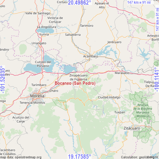
Bocaneo (San Pedro) GPS coordinates[2]
19° 50' 18.996" North, 100° 49' 1.992" West
| Map corner | latitude | longitude |
|---|---|---|
| Upper-left | 20.49862°, | -101.52035° |
| Center: | 19.83861°, | -100.81722° |
| Lower-right: | 19.17585°, | -100.1141° |
| Map W x H: | 147.1×147.1 km | = 91.4×91.4mi |
| max Lat: | 32.7° ⇑46.3% North |
| Bocaneo (San Pedro): | 19.83861° |
| min Lat: | ⇓53.7% South 14.53588° |
| min Long | Bocaneo (San Pe | max Long |
| -117.105° | -100.81722° | -86.73105° |
| W 28%⇐ | ⇒72% E |
Elevation
Elevation of Bocaneo (San Pedro) is 1879 m = 6165 ft, and this is 625.3 m = 2052 ft above average elevation for this country.
| Max E: |
3497 m = 11473 ft | 32.5% |
| Bocaneo (San Pedro) | 1879 m 6165 ft | |
| Avg. | 1253.7 m = 4113 ft | |
Min E: |
-1 m = -3 ft | 67.5% |
See also: Mexico elevation on elevation.city.
Geographical zone
Bocaneo (San Pedro) is located in North Torrid zone (between Equator and Tropic of Cancer). Distance of this Northern Tropic circle is 400.1 km =248.6 mi to North.| Distance of | km | miles | from Bocaneo (San Pedro) |
|---|---|---|---|
| North Pole | 7801.2 | 4847.4 | to North |
| Arctic Circle | 5195.3 | 3228.2 | to North |
| Tropic Cancer | 400.1 | 248.6 | to North |
| Equator | 2205.8 | 1370.6 | to South |


Nearby cities:
15 places around Bocaneo (San Pedro): (largest is in red/bold)
• Andocutín
14 km =8.7 mi,  338°
338°
• Araró
8.1 km =5 mi,  354°
354°
• Colonia de Guadalupe
11.1 km =6.9 mi,  247°
247°
• El Castillo
7.9 km =4.9 mi,  222°
222°
• Francisco Villa
13 km =8.1 mi,  288°
288°
• José María Morelos (La Yegüería)
7.1 km =4.4 mi, 293°
• Ojo de Agua de Bucio
11.3 km =7 mi,  124°
124°
• Pueblo Viejo
6.9 km =4.3 mi,  177°
177°
• Queréndaro
8.3 km =5.2 mi, 247°
• Río de Parras (Otzumatlán)
8.8 km =5.5 mi, 215°
• San Bartolomé Coro
8.7 km =5.4 mi,  315°
315°
• San Lucas Pío
12.3 km =7.6 mi, 246°
• San Miguel Taimeo
2.1 km =1.3 mi,  77°
77°
• Santa Clara del Tule
1.9 km =1.2 mi,  211°
211°
• Zinapécuaro
2.7 km =1.7 mi,  333°
333°
Sources, notices
• [Note1] Compared only with cities in Mexico existing in our database
• [Src1] Map data: © OpenStreetMap contributors (CC-BY-SA)
• [Src2] Other city data from geonames.org with taken over terms of usage.
• [Src3] Geographical zone / Annual Mean Temperature by Robert A. Rohde @ Wikipedia
