San Bartolomé Coro geodata
San Bartolomé Coro (Michoacán) is a populated place; located in Mexico in America/Mexico_City (GMT-6) time zone. With population of 512 people, there are 16417 cities with bigger population in this country. Compared to other cities in Mexico, 54.9% of cities are located further ↓South; 72.4% of cities are located further →East and 65.7% of cities have lower elevation than San Bartolomé Coro. Note1


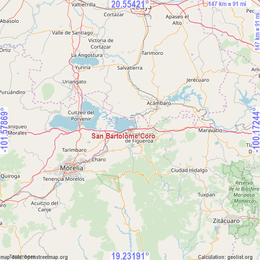
San Bartolomé Coro GPS coordinates[2]
19° 53' 39.984" North, 100° 52' 32.016" West
| Map corner | latitude | longitude |
|---|---|---|
| Upper-left | 20.55421°, | -101.57869° |
| Center: | 19.89444°, | -100.87556° |
| Lower-right: | 19.23191°, | -100.17244° |
| Map W x H: | 147×147 km | = 91.3×91.3mi |
| max Lat: | 32.7° ⇑45.1% North |
| San Bartolomé Coro: | 19.89444° |
| min Lat: | ⇓54.9% South 14.53588° |
| min Long | San Bartolomé | max Long |
| -117.105° | -100.87556° | -86.73105° |
| W 27.6%⇐ | ⇒72.4% E |
Elevation
Elevation of San Bartolomé Coro is 1845 m = 6053 ft, and this is 591.3 m = 1940 ft above average elevation for this country.
| Max E: |
3497 m = 11473 ft | 34.3% |
| San Bartolomé Coro | 1845 m 6053 ft | |
| Avg. | 1253.7 m = 4113 ft | |
Min E: |
-1 m = -3 ft | 65.7% |
See also: Mexico elevation on elevation.city.
Geographical zone
San Bartolomé Coro is located in North Torrid zone (between Equator and Tropic of Cancer). Distance of this Northern Tropic circle is 393.9 km =244.8 mi to North.| Distance of | km | miles | from San Bartolomé Coro |
|---|---|---|---|
| North Pole | 7795 | 4843.6 | to North |
| Arctic Circle | 5189.1 | 3224.4 | to North |
| Tropic Cancer | 393.9 | 244.8 | to North |
| Equator | 2212.1 | 1374.5 | to South |


Nearby cities:
15 places around San Bartolomé Coro: (largest is in red/bold)
• Andocutín
6.9 km =4.3 mi,  8°
8°
• Araró
5.7 km =3.5 mi,  70°
70°
• Belisario Domínguez
10.4 km =6.5 mi,  255°
255°
• Bocaneo (San Pedro)
8.7 km =5.4 mi,  135°
135°
• Colonia de Guadalupe
11.2 km =7 mi,  201°
201°
• Estación Queréndaro
7.7 km =4.8 mi, 260°
• Francisco Villa
6.7 km =4.2 mi,  251°
251°
• Irámuco
8.9 km =5.5 mi,  326°
326°
• José María Morelos (La Yegüería)
3.4 km =2.1 mi,  186°
186°
• La Mina
11.3 km =7 mi,  271°
271°
• Queréndaro
9.6 km =6 mi, 189°
• San Miguel Taimeo
10 km =6.2 mi,  125°
125°
• Santa Clara del Tule
9.3 km =5.8 mi,  147°
147°
• Tzintzimeo
11 km =6.8 mi, 255°
• Zinapécuaro
6.2 km =3.9 mi, 127°
Sources, notices
• [Note1] Compared only with cities in Mexico existing in our database
• [Src1] Map data: © OpenStreetMap contributors (CC-BY-SA)
• [Src2] Other city data from geonames.org with taken over terms of usage.
• [Src3] Geographical zone / Annual Mean Temperature by Robert A. Rohde @ Wikipedia
