Atlamajac geodata
Atlamajac (Guerrero) is a populated place; located in Mexico in America/Mexico_City (GMT-6) time zone. With population of 1,737 people, there are 4994 cities with bigger population in this country. Compared to other cities in Mexico, 82.5% of cities are located further ↑North; 56.7% of cities are located further ←West and 58.8% of cities have higher elevation than Atlamajac. Note1


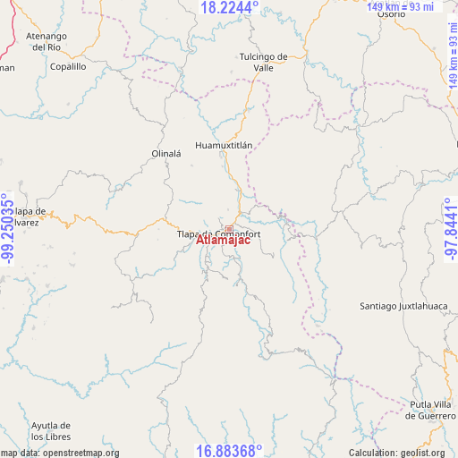
Atlamajac GPS coordinates[2]
17° 33' 19.008" North, 98° 32' 49.992" West
| Map corner | latitude | longitude |
|---|---|---|
| Upper-left | 18.2244°, | -99.25035° |
| Center: | 17.55528°, | -98.54722° |
| Lower-right: | 16.88368°, | -97.8441° |
| Map W x H: | 149.1×149.1 km | = 92.6×92.6mi |
| max Lat: | 32.7° ⇑82.5% North |
| Atlamajac: | 17.55528° |
| min Lat: | ⇓17.5% South 14.53588° |
| min Long | Atlamajac | max Long |
| -117.105° | -98.54722° | -86.73105° |
| W 56.7%⇐ | ⇒43.3% E |
Elevation
Elevation of Atlamajac is 1061 m = 3481 ft, and this is 192.7 m = 632 ft below average elevation for this country.
| Max E: |
3497 m = 11473 ft | 58.8% |
| Avg. | 1253.7 m = 4113 ft | |
| Atlamajac | 1061 m = 3481 ft | |
Min E: |
-1 m = -3 ft | 41.2% |
See also: Mexico elevation on elevation.city.
Geographical zone
Atlamajac is located in North Torrid zone (between Equator and Tropic of Cancer). Distance of this Northern Tropic circle is 654 km =406.4 mi to North.| Distance of | km | miles | from Atlamajac |
|---|---|---|---|
| North Pole | 8055.1 | 5005.2 | to North |
| Arctic Circle | 5449.2 | 3386 | to North |
| Tropic Cancer | 654 | 406.4 | to North |
| Equator | 1952 | 1212.9 | to South |


Nearby cities:
15 places around Atlamajac: (largest is in red/bold)
• Ahuatepec Ejido
5.6 km =3.5 mi,  257°
257°
• Ahuatepec Pueblo
7.2 km =4.5 mi,  321°
321°
• Colonia Constitución
5.9 km =3.7 mi,  249°
249°
• Cuba Libre
9.9 km =6.2 mi,  148°
148°
• El Platanar (Santa María Guadalupe el Platanar)
8.7 km =5.4 mi, 149°
• Igualita
11.1 km =6.9 mi,  162°
162°
• Ixcateopan
7.8 km =4.8 mi,  26°
26°
• La Soledad
7.1 km =4.4 mi, 262°
• Tenango Tepexi
11.1 km =6.9 mi,  301°
301°
• Tlapa de Comonfort
3.2 km =2 mi, 249°
• Tlaquilzingo
10 km =6.2 mi,  237°
237°
• Tlatzala
6.6 km =4.1 mi,  357°
357°
• Xalatzala
9.5 km =5.9 mi,  197°
197°
• Xalpatlahuac
11.3 km =7 mi,  213°
213°
• Zacatipa
10.9 km =6.8 mi, 205°
Sources, notices
• [Note1] Compared only with cities in Mexico existing in our database
• [Src1] Map data: © OpenStreetMap contributors (CC-BY-SA)
• [Src2] Other city data from geonames.org with taken over terms of usage.
• [Src3] Geographical zone / Annual Mean Temperature by Robert A. Rohde @ Wikipedia
