Ahuatepec Pueblo geodata
Ahuatepec Pueblo (Guerrero) is a populated place; located in Mexico in America/Mexico_City (GMT-6) time zone. With population of 1,337 people, there are 6503 cities with bigger population in this country. Compared to other cities in Mexico, 82.2% of cities are located further ↑North; 56.2% of cities are located further ←West and 50.3% of cities have higher elevation than Ahuatepec Pueblo. Note1


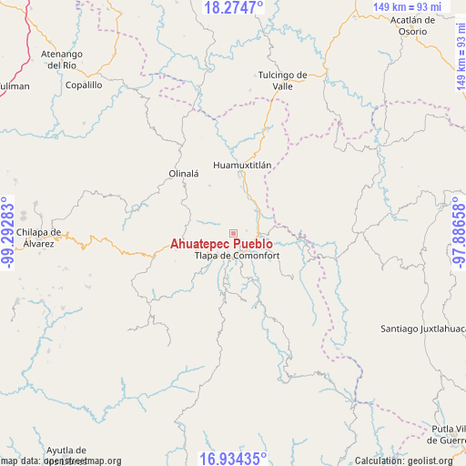
Ahuatepec Pueblo GPS coordinates[2]
17° 36' 20.772" North, 98° 35' 22.92" West
| Map corner | latitude | longitude |
|---|---|---|
| Upper-left | 18.2747°, | -99.29283° |
| Center: | 17.60577°, | -98.5897° |
| Lower-right: | 16.93435°, | -97.88658° |
| Map W x H: | 149×149 km | = 92.6×92.6mi |
| max Lat: | 32.7° ⇑82.2% North |
| Ahuatepec Pueblo: | 17.60577° |
| min Lat: | ⇓17.8% South 14.53588° |
| min Long | Ahuatepec Puebl | max Long |
| -117.105° | -98.5897° | -86.73105° |
| W 56.2%⇐ | ⇒43.8% E |
Elevation
Elevation of Ahuatepec Pueblo is 1414 m = 4639 ft, and this is 160.3 m = 526 ft above average elevation for this country.
| Max E: |
3497 m = 11473 ft | 50.3% |
| Ahuatepec Pueblo | 1414 m 4639 ft | |
| Avg. | 1253.7 m = 4113 ft | |
Min E: |
-1 m = -3 ft | 49.7% |
See also: Mexico elevation on elevation.city.
Geographical zone
Ahuatepec Pueblo is located in North Torrid zone (between Equator and Tropic of Cancer). Distance of this Northern Tropic circle is 648.3 km =402.8 mi to North.| Distance of | km | miles | from Ahuatepec Pueblo |
|---|---|---|---|
| North Pole | 8049.5 | 5001.7 | to North |
| Arctic Circle | 5443.6 | 3382.5 | to North |
| Tropic Cancer | 648.3 | 402.8 | to North |
| Equator | 1957.6 | 1216.4 | to South |


Nearby cities:
15 places around Ahuatepec Pueblo: (largest is in red/bold)
• Ahuatepec Ejido
6.9 km =4.3 mi,  187°
187°
• Alpoyeca
11.1 km =6.9 mi,  49°
49°
• Atlamajac
7.2 km =4.5 mi,  141°
141°
• Chiepetlán (San Miguel Chiepetlán)
8 km =5 mi,  313°
313°
• Coachimalco
9.9 km =6.2 mi,  282°
282°
• Colonia Constitución
7.8 km =4.8 mi, 187°
• Ixcateopan
8.1 km =5 mi,  80°
80°
• La Soledad
7 km =4.3 mi,  201°
201°
• San José Buenavista
10.1 km =6.3 mi,  42°
42°
• San Miguel Axoxuca
9.9 km =6.2 mi,  230°
230°
• San Pedro Petlacala
9.4 km =5.8 mi,  253°
253°
• Tenango Tepexi
5 km =3.1 mi,  272°
272°
• Tlapa de Comonfort
6.9 km =4.3 mi,  167°
167°
• Tlatzala
4.4 km =2.7 mi, 76°
• Zacualpan
7.7 km =4.8 mi,  349°
349°
Sources, notices
• [Note1] Compared only with cities in Mexico existing in our database
• [Src1] Map data: © OpenStreetMap contributors (CC-BY-SA)
• [Src2] Other city data from geonames.org with taken over terms of usage.
• [Src3] Geographical zone / Annual Mean Temperature by Robert A. Rohde @ Wikipedia
