Tlatzala geodata
Tlatzala (Guerrero) is a populated place; located in Mexico in America/Mexico_City (GMT-6) time zone. With population of 1,387 people, there are 6236 cities with bigger population in this country. Compared to other cities in Mexico, 82.1% of cities are located further ↑North; 56.7% of cities are located further ←West and 51.3% of cities have lower elevation than Tlatzala. Note1


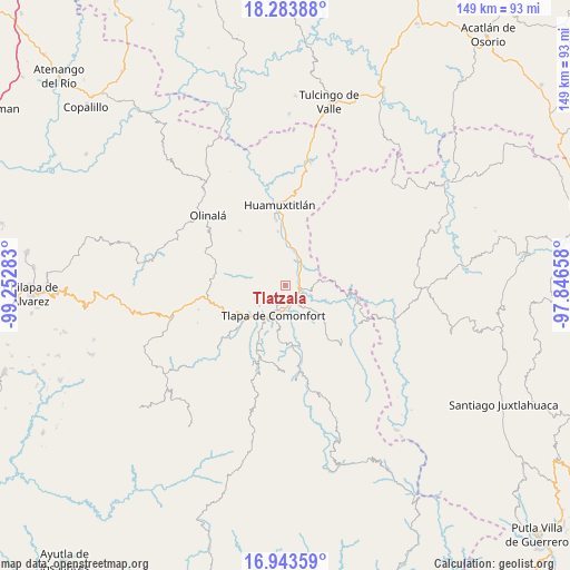
Tlatzala GPS coordinates[2]
17° 36' 53.928" North, 98° 32' 58.92" West
| Map corner | latitude | longitude |
|---|---|---|
| Upper-left | 18.28388°, | -99.25283° |
| Center: | 17.61498°, | -98.5497° |
| Lower-right: | 16.94359°, | -97.84658° |
| Map W x H: | 149×149 km | = 92.6×92.6mi |
| max Lat: | 32.7° ⇑82.1% North |
| Tlatzala: | 17.61498° |
| min Lat: | ⇓17.9% South 14.53588° |
| min Long | Tlatzala | max Long |
| -117.105° | -98.5497° | -86.73105° |
| W 56.7%⇐ | ⇒43.3% E |
Elevation
Elevation of Tlatzala is 1498 m = 4915 ft, and this is 244.3 m = 802 ft above average elevation for this country.
| Max E: |
3497 m = 11473 ft | 48.7% |
| Tlatzala | 1498 m 4915 ft | |
| Avg. | 1253.7 m = 4113 ft | |
Min E: |
-1 m = -3 ft | 51.3% |
See also: Mexico elevation on elevation.city.
Geographical zone
Tlatzala is located in North Torrid zone (between Equator and Tropic of Cancer). Distance of this Northern Tropic circle is 647.3 km =402.2 mi to North.| Distance of | km | miles | from Tlatzala |
|---|---|---|---|
| North Pole | 8048.5 | 5001.1 | to North |
| Arctic Circle | 5442.6 | 3381.9 | to North |
| Tropic Cancer | 647.3 | 402.2 | to North |
| Equator | 1958.6 | 1217 | to South |


Nearby cities:
15 places around Tlatzala: (largest is in red/bold)
• Ahuatepec Ejido
9.4 km =5.8 mi,  213°
213°
• Ahuatepec Pueblo
4.4 km =2.7 mi,  256°
256°
• Alpoyeca
7.5 km =4.7 mi,  34°
34°
• Atlamajac
6.6 km =4.1 mi,  177°
177°
• Chiepetlán (San Miguel Chiepetlán)
11 km =6.8 mi,  293°
293°
• Colonia Constitución
10.2 km =6.3 mi, 211°
• Ixcateopan
3.8 km =2.4 mi,  84°
84°
• La Soledad
10.1 km =6.3 mi,  222°
222°
• San José Buenavista
7 km =4.3 mi,  21°
21°
• San Pedro Aytec
9.5 km =5.9 mi, 15°
• Tecoyame de Guadalupe
10.3 km =6.4 mi, 84°
• Tenango Tepexi
9.3 km =5.8 mi,  265°
265°
• Tlalquetzala
10.2 km =6.3 mi,  6°
6°
• Tlapa de Comonfort
8.2 km =5.1 mi,  199°
199°
• Zacualpan
8.6 km =5.3 mi,  318°
318°
Sources, notices
• [Note1] Compared only with cities in Mexico existing in our database
• [Src1] Map data: © OpenStreetMap contributors (CC-BY-SA)
• [Src2] Other city data from geonames.org with taken over terms of usage.
• [Src3] Geographical zone / Annual Mean Temperature by Robert A. Rohde @ Wikipedia
