Ixcateopan geodata
Ixcateopan (Guerrero) is a populated place; located in Mexico in America/Mexico_City (GMT-6) time zone. With population of 1,424 people, there are 6068 cities with bigger population in this country. Compared to other cities in Mexico, 82% of cities are located further ↑North; 57% of cities are located further ←West and 60% of cities have higher elevation than Ixcateopan. Note1


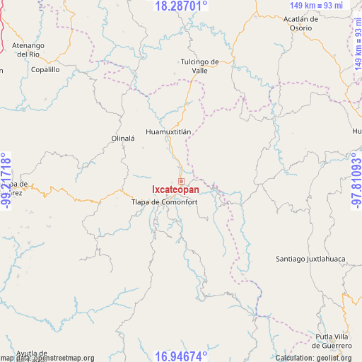
Ixcateopan GPS coordinates[2]
17° 37' 5.232" North, 98° 30' 50.58" West
| Map corner | latitude | longitude |
|---|---|---|
| Upper-left | 18.28701°, | -99.21718° |
| Center: | 17.61812°, | -98.51405° |
| Lower-right: | 16.94674°, | -97.81093° |
| Map W x H: | 149×149 km | = 92.6×92.6mi |
| max Lat: | 32.7° ⇑82% North |
| Ixcateopan: | 17.61812° |
| min Lat: | ⇓18% South 14.53588° |
| min Long | Ixcateopan | max Long |
| -117.105° | -98.51405° | -86.73105° |
| W 57%⇐ | ⇒43% E |
Elevation
Elevation of Ixcateopan is 1000 m = 3281 ft, and this is 253.7 m = 832 ft below average elevation for this country.
| Max E: |
3497 m = 11473 ft | 60% |
| Avg. | 1253.7 m = 4113 ft | |
| Ixcateopan | 1000 m = 3281 ft | |
Min E: |
-1 m = -3 ft | 40% |
See also: Mexico elevation on elevation.city.
Geographical zone
Ixcateopan is located in North Torrid zone (between Equator and Tropic of Cancer). Distance of this Northern Tropic circle is 647 km =402 mi to North.| Distance of | km | miles | from Ixcateopan |
|---|---|---|---|
| North Pole | 8048.1 | 5000.9 | to North |
| Arctic Circle | 5442.2 | 3381.6 | to North |
| Tropic Cancer | 647 | 402 | to North |
| Equator | 1959 | 1217.3 | to South |


Nearby cities:
15 places around Ixcateopan: (largest is in red/bold)
• Ahuatepec Ejido
12.1 km =7.5 mi,  227°
227°
• Ahuatepec Pueblo
8.1 km =5 mi,  260°
260°
• Alpoyeca
5.8 km =3.6 mi,  4°
4°
• Atlamajac
7.8 km =4.8 mi,  206°
206°
• Colonia Constitución
12.8 km =8 mi,  224°
224°
• San José Buenavista
6.3 km =3.9 mi,  348°
348°
• San Mateo Nejápam
11.2 km =7 mi,  67°
67°
• San Pedro Aytec
8.9 km =5.5 mi, 351°
• Tecoyame de Guadalupe
6.5 km =4 mi,  84°
84°
• Tenango Tepexi
13.1 km =8.1 mi, 264°
• Tlalquetzala
10.1 km =6.3 mi, 345°
• Tlapa de Comonfort
10.4 km =6.5 mi, 219°
• Tlaquiltepec
13.1 km =8.1 mi,  344°
344°
• Tlatzala
3.8 km =2.4 mi, 264°
• Zacualpan
11.3 km =7 mi,  303°
303°
Sources, notices
• [Note1] Compared only with cities in Mexico existing in our database
• [Src1] Map data: © OpenStreetMap contributors (CC-BY-SA)
• [Src2] Other city data from geonames.org with taken over terms of usage.
• [Src3] Geographical zone / Annual Mean Temperature by Robert A. Rohde @ Wikipedia
