San Antonio Coyahuacán geodata
San Antonio Coyahuacán (Guerrero) is a populated place; located in Mexico in America/Mexico_City (GMT-6) time zone. With population of 1,666 people, there are 5219 cities with bigger population in this country. Compared to other cities in Mexico, 80% of cities are located further ↑North; 55.3% of cities are located further ←West and 53.3% of cities have lower elevation than San Antonio Coyahuacán. Note1
Current local time in San Antonio Coyahuacán:
08:28 AM, WednesdayDifference from your time zone: hours


San Antonio Coyahuacán GPS coordinates[2]
17° 51' 42.984" North, 98° 40' 48" West
| Map corner | latitude | longitude |
|---|---|---|
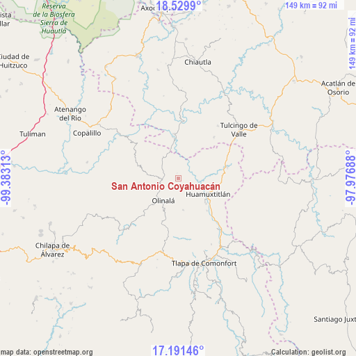
| Upper-left | 18.5299°, | -99.38313° |
| Center: | 17.86194°, | -98.68° |
| Lower-right: | 17.19146°, | -97.97688° |
| Map W x H: | 148.8×148.8 km | = 92.5×92.5mi |
| max Lat: | 32.7° ⇑80% North |
| San Antonio Coyahuacán: | 17.86194° |
| min Lat: | ⇓20% South 14.53588° |
| min Long | San Antonio Coy | max Long |
| -117.105° | -98.68° | -86.73105° |
| W 55.3%⇐ | ⇒44.7% E |
Elevation
Elevation of San Antonio Coyahuacán is 1546 m = 5072 ft, and this is 292.3 m = 959 ft above average elevation for this country.
| Max E: |
3497 m = 11473 ft | 46.7% |
| San Antonio Coyahuacán | 1546 m 5072 ft | |
| Avg. | 1253.7 m = 4113 ft | |
Min E: |
-1 m = -3 ft | 53.3% |
See also: Mexico elevation on elevation.city.
Geographical zone
San Antonio Coyahuacán is located in North Torrid zone (between Equator and Tropic of Cancer). Distance of this Northern Tropic circle is 619.9 km =385.2 mi to North.| Distance of | km | miles | from San Antonio Coyahuacán |
|---|---|---|---|
| North Pole | 8021 | 4984 | to North |
| Arctic Circle | 5415.1 | 3364.8 | to North |
| Tropic Cancer | 619.9 | 385.2 | to North |
| Equator | 1986.1 | 1234.1 | to South |


Nearby cities:
15 places around San Antonio Coyahuacán: (largest is in red/bold)
• Ahuacatlán
7.1 km =4.4 mi,  322°
322°
• Amatlicha
13.6 km =8.5 mi,  253°
253°
• Chiaucingo
13.5 km =8.4 mi,  187°
187°
• Coyahualco
18 km =11.2 mi,  138°
138°
• Cualác
13.3 km =8.3 mi,  171°
171°
• Huamuxtitlán
13.8 km =8.6 mi,  117°
117°
• La Libertad
14.4 km =8.9 mi,  205°
205°
• Olinalá
11.2 km =7 mi, 214°
• San Martín Jolalpan
15.6 km =9.7 mi,  175°
175°
• San Miguel Comitlipa
17.8 km =11.1 mi,  49°
49°
• Santa Cruz
15.6 km =9.7 mi,  132°
132°
• Santa Cruz Lomalapa (Lomalapa)
6 km =3.7 mi,  8°
8°
• Tepetlacingo
10.9 km =6.8 mi,  306°
306°
• Toltecamila
12.9 km =8 mi,  30°
30°
• Zumpango
8.2 km =5.1 mi,  357°
357°
Sources, notices
• [Note1] Compared only with cities in Mexico existing in our database
• [Src1] Map data: © OpenStreetMap contributors (CC-BY-SA)
• [Src2] Other city data from geonames.org with taken over terms of usage.
• [Src3] Geographical zone / Annual Mean Temperature by Robert A. Rohde @ Wikipedia
