Ex-Hacienda del Copal geodata
Ex-Hacienda del Copal (Guanajuato) is a populated place; located in Mexico in America/Mexico_City (GMT-6) time zone. With population of 1,431 people, there are 6034 cities with bigger population in this country. Compared to other cities in Mexico, 72.4% of cities are located further ↓South; 75.9% of cities are located further →East and 61.8% of cities have lower elevation than Ex-Hacienda del Copal. Note1


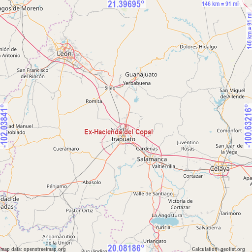
Ex-Hacienda del Copal GPS coordinates[2]
20° 44' 26.988" North, 101° 20' 7.008" West
| Map corner | latitude | longitude |
|---|---|---|
| Upper-left | 21.39695°, | -102.03841° |
| Center: | 20.74083°, | -101.33528° |
| Lower-right: | 20.08186°, | -100.63216° |
| Map W x H: | 146.2×146.2 km | = 90.8×90.8mi |
| max Lat: | 32.7° ⇑27.6% North |
| Ex-Hacienda del Copal: | 20.74083° |
| min Lat: | ⇓72.4% South 14.53588° |
| min Long | Ex-Hacienda del | max Long |
| -117.105° | -101.33528° | -86.73105° |
| W 24.1%⇐ | ⇒75.9% E |
Elevation
Elevation of Ex-Hacienda del Copal is 1756 m = 5761 ft, and this is 502.3 m = 1648 ft above average elevation for this country.
| Max E: |
3497 m = 11473 ft | 38.2% |
| Ex-Hacienda del Copal | 1756 m 5761 ft | |
| Avg. | 1253.7 m = 4113 ft | |
Min E: |
-1 m = -3 ft | 61.8% |
See also: Mexico elevation on elevation.city.
Geographical zone
Ex-Hacienda del Copal is located in North Torrid zone (between Equator and Tropic of Cancer). Distance of this Northern Tropic circle is 299.8 km =186.3 mi to North.| Distance of | km | miles | from Ex-Hacienda del Copal |
|---|---|---|---|
| North Pole | 7700.9 | 4785.1 | to North |
| Arctic Circle | 5095 | 3165.9 | to North |
| Tropic Cancer | 299.8 | 186.3 | to North |
| Equator | 2306.2 | 1433 | to South |


Nearby cities:
15 places around Ex-Hacienda del Copal: (largest is in red/bold)
• Arandas
4.3 km =2.7 mi,  245°
245°
• Carrizal Grande
4.9 km =3 mi,  141°
141°
• El Carrizalito
4.3 km =2.7 mi,  164°
164°
• El Copalillo
1.8 km =1.1 mi,  216°
216°
• Fraccionamiento Campestre las Flores
2 km =1.2 mi,  214°
214°
• Guadalupe de Paso Blanco
7.3 km =4.5 mi,  282°
282°
• Hacienda de Márquez
5.1 km =3.2 mi,  329°
329°
• La Calera
6.7 km =4.2 mi,  2°
2°
• La Garrida
2.8 km =1.7 mi,  289°
289°
• Lo de Juárez
3.1 km =1.9 mi,  348°
348°
• Nueva Colonia Copalillo (El Atorón)
4.3 km =2.7 mi, 286°
• Peñuelas
4.8 km =3 mi,  124°
124°
• Purísima del Progreso
5.9 km =3.7 mi,  5°
5°
• Taretán
4.2 km =2.6 mi, 0°
• Valencianita
3.5 km =2.2 mi,  78°
78°
Sources, notices
• [Note1] Compared only with cities in Mexico existing in our database
• [Src1] Map data: © OpenStreetMap contributors (CC-BY-SA)
• [Src2] Other city data from geonames.org with taken over terms of usage.
• [Src3] Geographical zone / Annual Mean Temperature by Robert A. Rohde @ Wikipedia
