Abrevadero geodata
Abrevadero (Veracruz) is a populated place; located in Mexico in America/Mexico_City (GMT-6) time zone. With population of 1,425 people, there are 6062 cities with bigger population in this country. Compared to other cities in Mexico, 75.1% of cities are located further ↑North; 83.9% of cities are located further ←West and 82% of cities have higher elevation than Abrevadero. Note1


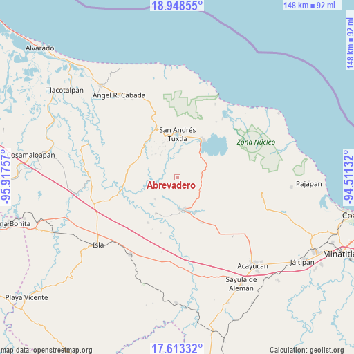
Abrevadero GPS coordinates[2]
18° 16' 55.992" North, 95° 12' 51.984" West
| Map corner | latitude | longitude |
|---|---|---|
| Upper-left | 18.94855°, | -95.91757° |
| Center: | 18.28222°, | -95.21444° |
| Lower-right: | 17.61332°, | -94.51132° |
| Map W x H: | 148.5×148.5 km | = 92.3×92.3mi |
| max Lat: | 32.7° ⇑75.1% North |
| Abrevadero: | 18.28222° |
| min Lat: | ⇓24.9% South 14.53588° |
| min Long | Abrevadero | max Long |
| -117.105° | -95.21444° | -86.73105° |
| W 83.9%⇐ | ⇒16.1% E |
Elevation
Elevation of Abrevadero is 70 m = 230 ft, and this is 1183.7 m = 3884 ft below average elevation for this country.
| Max E: |
3497 m = 11473 ft | 82% |
| Avg. | 1253.7 m = 4113 ft | |
| Abrevadero | 70 m = 230 ft | |
Min E: |
-1 m = -3 ft | 18% |
See also: Mexico elevation on elevation.city.
Geographical zone
Abrevadero is located in North Torrid zone (between Equator and Tropic of Cancer). Distance of this Northern Tropic circle is 573.1 km =356.1 mi to North.| Distance of | km | miles | from Abrevadero |
|---|---|---|---|
| North Pole | 7974.3 | 4955 | to North |
| Arctic Circle | 5368.4 | 3335.8 | to North |
| Tropic Cancer | 573.1 | 356.1 | to North |
| Equator | 2032.8 | 1263.1 | to South |


Nearby cities:
15 places around Abrevadero: (largest is in red/bold)
• Apixita
9.1 km =5.7 mi,  294°
294°
• Chuniapan de Abajo
8.5 km =5.3 mi,  354°
354°
• Chuniapan de Arriba
8.1 km =5 mi,  25°
25°
• Cuesta Amarilla
7.5 km =4.7 mi,  344°
344°
• Cuesta de Laja
1.4 km =0.9 mi,  330°
330°
• El Popotal
10.3 km =6.4 mi,  247°
247°
• El Remolino
5.4 km =3.4 mi, 286°
• Juan Jacobo Torres [Bodega de Totontepec]
7.7 km =4.8 mi,  321°
321°
• La Candelaria
10.3 km =6.4 mi,  59°
59°
• La Redonda
10 km =6.2 mi,  299°
299°
• Laguneta
9.5 km =5.9 mi,  44°
44°
• Los Naranjos
6.1 km =3.8 mi, 332°
• San Juan Seco de Valencia
6.9 km =4.3 mi, 63°
• Tulapam
3.8 km =2.4 mi, 340°
• Zapoapan de Amapan
5.9 km =3.7 mi,  147°
147°
Sources, notices
• [Note1] Compared only with cities in Mexico existing in our database
• [Src1] Map data: © OpenStreetMap contributors (CC-BY-SA)
• [Src2] Other city data from geonames.org with taken over terms of usage.
• [Src3] Geographical zone / Annual Mean Temperature by Robert A. Rohde @ Wikipedia
