Buena Vista (Puxcatán) geodata
Buena Vista (Puxcatán) (Tabasco) is a populated place; located in Mexico in America/Mexico_City (GMT-6) time zone. With population of 1,415 people, there are 6109 cities with bigger population in this country. Compared to other cities in Mexico, 81.1% of cities are located further ↑North; 91% of cities are located further ←West and 94.6% of cities have higher elevation than Buena Vista (Puxcatán). Note1


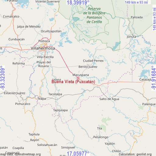
Buena Vista (Puxcatán) GPS coordinates[2]
17° 43' 50.628" North, 92° 37' 11.856" West
| Map corner | latitude | longitude |
|---|---|---|
| Upper-left | 18.39919°, | -93.32309° |
| Center: | 17.73073°, | -92.61996° |
| Lower-right: | 17.05977°, | -91.91684° |
| Map W x H: | 148.9×148.9 km | = 92.5×92.5mi |
| max Lat: | 32.7° ⇑81.1% North |
| Buena Vista (Puxcatán): | 17.73073° |
| min Lat: | ⇓18.9% South 14.53588° |
| min Long | Buena Vista (Pu | max Long |
| -117.105° | -92.61996° | -86.73105° |
| W 91%⇐ | ⇒9% E |
Elevation
Elevation of Buena Vista (Puxcatán) is 14 m = 46 ft, and this is 1239.7 m = 4067 ft below average elevation for this country.
| Max E: |
3497 m = 11473 ft | 94.6% |
| Avg. | 1253.7 m = 4113 ft | |
| Buena Vista (Puxcatán) | 14 m = 46 ft | |
Min E: |
-1 m = -3 ft | 5.4% |
See also: Mexico elevation on elevation.city.
Geographical zone
Buena Vista (Puxcatán) is located in North Torrid zone (between Equator and Tropic of Cancer). Distance of this Northern Tropic circle is 634.4 km =394.2 mi to North.| Distance of | km | miles | from Buena Vista (Puxcatán) |
|---|---|---|---|
| North Pole | 8035.6 | 4993.1 | to North |
| Arctic Circle | 5429.7 | 3373.9 | to North |
| Tropic Cancer | 634.4 | 394.2 | to North |
| Equator | 1971.5 | 1225 | to South |


Nearby cities:
15 places around Buena Vista (Puxcatán): (largest is in red/bold)
• Belén
6.6 km =4.1 mi,  7°
7°
• Buergos
9.8 km =6.1 mi,  345°
345°
• Cacahuatalillo
13.4 km =8.3 mi,  45°
45°
• Calicanto 2da. Sección
10.9 km =6.8 mi,  240°
240°
• Chichonal 3ra. Sección (La Capilla)
7.5 km =4.7 mi,  307°
307°
• Emiliano Zapata 2da. Sección
13.8 km =8.6 mi, 11°
• Francisco Villa
10.5 km =6.5 mi,  140°
140°
• Ignacio Zaragoza (Los Ateos)
6.5 km =4 mi,  33°
33°
• Lerdo de Tejada 2da. Sección
6.8 km =4.2 mi,  332°
332°
• Macuspana
4.2 km =2.6 mi,  38°
38°
• Monte Largo 1ra. Sección
11.8 km =7.3 mi, 6°
• Nicolás Bravo
1.7 km =1.1 mi,  173°
173°
• San Carlos
14.9 km =9.3 mi, 39°
• San Miguel Adentro 1ra. Sección
9.9 km =6.2 mi,  264°
264°
• Veinte de Noviembre
13.3 km =8.3 mi, 14°
Sources, notices
• [Note1] Compared only with cities in Mexico existing in our database
• [Src1] Map data: © OpenStreetMap contributors (CC-BY-SA)
• [Src2] Other city data from geonames.org with taken over terms of usage.
• [Src3] Geographical zone / Annual Mean Temperature by Robert A. Rohde @ Wikipedia
