Veinte de Noviembre geodata
Veinte de Noviembre (Tabasco) is a populated place; located in Mexico in America/Mexico_City (GMT-6) time zone. With population of 1,022 people, there are 8517 cities with bigger population in this country. Compared to other cities in Mexico, 80.1% of cities are located further ↑North; 91.2% of cities are located further ←West and 87.2% of cities have higher elevation than Veinte de Noviembre. Note1


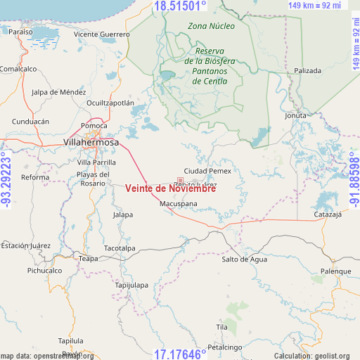
Veinte de Noviembre GPS coordinates[2]
17° 50' 49.164" North, 92° 35' 20.76" West
| Map corner | latitude | longitude |
|---|---|---|
| Upper-left | 18.51501°, | -93.29223° |
| Center: | 17.84699°, | -92.5891° |
| Lower-right: | 17.17646°, | -91.88598° |
| Map W x H: | 148.8×148.8 km | = 92.5×92.5mi |
| max Lat: | 32.7° ⇑80.1% North |
| Veinte de Noviembre: | 17.84699° |
| min Lat: | ⇓19.9% South 14.53588° |
| min Long | Veinte de Novie | max Long |
| -117.105° | -92.5891° | -86.73105° |
| W 91.2%⇐ | ⇒8.8% E |
Elevation
Elevation of Veinte de Noviembre is 33 m = 108 ft, and this is 1220.7 m = 4005 ft below average elevation for this country.
| Max E: |
3497 m = 11473 ft | 87.2% |
| Avg. | 1253.7 m = 4113 ft | |
| Veinte de Noviembre | 33 m = 108 ft | |
Min E: |
-1 m = -3 ft | 12.8% |
See also: Mexico elevation on elevation.city.
Geographical zone
Veinte de Noviembre is located in North Torrid zone (between Equator and Tropic of Cancer). Distance of this Northern Tropic circle is 621.5 km =386.2 mi to North.| Distance of | km | miles | from Veinte de Noviembre |
|---|---|---|---|
| North Pole | 8022.7 | 4985.1 | to North |
| Arctic Circle | 5416.8 | 3365.8 | to North |
| Tropic Cancer | 621.5 | 386.2 | to North |
| Equator | 1984.4 | 1233 | to South |


Nearby cities:
15 places around Veinte de Noviembre: (largest is in red/bold)
• Belén
6.9 km =4.3 mi,  200°
200°
• Buenavista
9.7 km =6 mi,  37°
37°
• Buergos
6.7 km =4.2 mi,  238°
238°
• Cacahuatalillo
7.3 km =4.5 mi,  119°
119°
• El Bayo 1ra. Sección (Granada)
9.9 km =6.2 mi,  96°
96°
• Emiliano Zapata 2da. Sección
0.7 km =0.4 mi,  318°
318°
• Ignacio Zaragoza (Los Ateos)
7.5 km =4.7 mi,  177°
177°
• La Escalera
6.7 km =4.2 mi,  93°
93°
• La Unión
9.8 km =6.1 mi, 89°
• Lerdo de Tejada 2da. Sección
9.4 km =5.8 mi,  223°
223°
• Macuspana
9.6 km =6 mi, 183°
• Monte Largo 1ra. Sección
2.2 km =1.4 mi, 235°
• Morelos
8.3 km =5.2 mi,  353°
353°
• Nueva Esperanza
5.6 km =3.5 mi,  58°
58°
• San Carlos
6.5 km =4 mi, 103°
Sources, notices
• [Note1] Compared only with cities in Mexico existing in our database
• [Src1] Map data: © OpenStreetMap contributors (CC-BY-SA)
• [Src2] Other city data from geonames.org with taken over terms of usage.
• [Src3] Geographical zone / Annual Mean Temperature by Robert A. Rohde @ Wikipedia
